
Primary outflows Medicine Creek Surface elevation 410 m | Primary inflows Catchment area 92 sq mi (240 km) Area 9.409 km² Year built 1905 | |
 | ||
Similar Mount Scott, Elmer Thomas Lake, Lake Jed Johnson, Museum of the Great Plains, Lake of the Arbuckles | ||
Lake lawtonka oct 5 2015
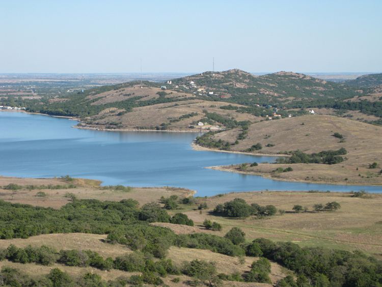
Lake Lawtonka is a lake in Comanche County in the state of Oklahoma in the United States.
Contents
- Lake lawtonka oct 5 2015
- Map of Lake Lawtonka Oklahoma 73507 USA
- Lake lawtonka ok saugeye fishing southwest outdoors report 6 2012 season
- RecreationEdit
- References
Map of Lake Lawtonka, Oklahoma 73507, USA
The lake is 2 square miles (5 square kilometers) in area. It is formed by a dam 60 feet (18 meters) high and 375 feet (114 meters) long across Medicine Bluff Creek. The lake provides the water supply for Fort Sill and Lawton to the south.
Lake lawtonka ok saugeye fishing southwest outdoors report 6 2012 season
RecreationEdit
Fishing and camping facilities are maintained by the City of Lawton, Oklahoma.
References
Lake Lawtonka Wikipedia(Text) CC BY-SA