
Type Endorheic Surface elevation 73 m Mean depth 9 m Width 1 km | Primary outflows none Max. length 4.2 km (2.6 mi) Area 194 ha Length 4.2 km | |
 | ||
Primary inflows | ||
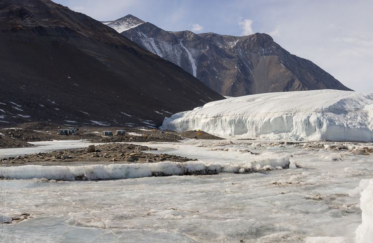
Lake hoare field camp dry valleys antarctica
Lake Hoare is a lake about 4.2 kilometres (2.6 mi) long between Lake Chad and Canada Glacier in Taylor Valley, Victoria Land, Antarctica. Its surface area measures 1.94 square kilometres (0.75 sq mi). The lake was named by the 8th Victoria University of Wellington Antarctic Expedition (VUWAE), 1963–64, for physicist Ray A. Hoare, a member of the VUWAE that examined lakes in Taylor, Wright, and Victoria Valleys.
Contents
- Lake hoare field camp dry valleys antarctica
- Map of Lake Hoare Antarctica
- 360 degrees at lake hoare camp
- References
Map of Lake Hoare, Antarctica
Lake Hoare is dammed by the tongue of Canada Glacier, otherwise it would drain into Lake Fryxell, 3 kilometres (1.9 mi) northeast across the glacier tongue. Lake Chad, only 5 metres (5.5 yd) southeast of Lake Hoare, sometimes overflows into Lake Hoare.
360 degrees at lake hoare camp
References
Lake Hoare Wikipedia(Text) CC BY-SA