
Max. width 40 km (25 mi) Area 2,325 km² Catchment area 12,096 km² Length 77 km | Max. length 77 km (48 mi) Surface area 2,325 km (898 sq mi) Surface elevation 912 m Volume 39 km³ Mean depth 17 m | |
 | ||
Primary inflows Basin countries Democratic Republic of CongoUganda | ||
Lake Edward, Rutanzige or Edward Nyanza is the smallest of the African Great Lakes. It is located in the Albertine Rift, the western branch of the East African Rift, on the border between the Democratic Republic of the Congo (DRC) and Uganda, with its northern shore a few kilometres south of the equator.
Contents
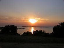
Map of Lake Edward
History
Henry Morton Stanley first saw the lake in 1888, during the Emin Pasha Relief Expedition. The lake was named in honour of Prince Albert Edward, The Prince of Wales, son of then British-monarch Queen Victoria, and later to become King Edward VII.
In 1973, Uganda and Zaire (DRC) renamed it Lake Idi Amin or Lake Idi Amin Dada after Ugandan dictator Idi Amin. After his overthrow in 1979, it recovered its original name.
Topography and drainage
Lake Edward lies at an elevation of 920 metres (3,020 ft), is 77 kilometres (48 mi) long by 40 kilometres (25 mi) wide at its maximum points, and covers a total surface area of 2,325 square kilometres (898 sq mi), making it the 15th-largest on the continent. The lake is fed by the Nyamugasani River, the Ishasha River, the Rutshuru River, the Ntungwe River, the Rwindi River and Lake George to the northeast empties into it via the Kazinga Channel. It empties to the north via the Semliki River into Lake Albert.
The western escarpment of the Great Rift Valley towers up to 2,000 metres (6,600 ft) above the western shore of the lake. The southern and eastern shores are flat lava plains. The Ruwenzori Mountains are 20 kilometres (12 mi) north of the lake.
Volcanism
The region shows much evidence of volcanic activity over the last 5000 years. The Katwe-Kikorongo and Bunyaruguru Volcanic Fields, with extensive cones and craters, lie either side of the Kazinga Channel on the northwest shore of the lake. It is thought that Lakes George and Edward used to be joined as one larger lake, but lava from these fields flowed in and divided it, leaving only the Kazinga Channel as the remnant of the past union. To the south lies the May-ya-Moto thermally active volcano 30 kilometres (19 mi) away, and the Nyamuragira volcano in the western Virunga Mountains lies 80 kilometres (50 mi) south, but its lava flows have reached the lake in the past.
The Katwe-Kikorongo field features dozens of large craters and cones covering an area of 30 kilometres (19 mi) by 15 kilometres (9.3 mi) between lakes Edward and George, and includes seven crater lakes. The largest of these, the 2.5 kilometres (1.6 mi) long Lake Katwe, occupies a crater 4 kilometres (2.5 mi) across and is separated from Lake Edward by just 300 metres (980 ft) of land. The crater is about 100 metres (330 ft) deep, and Lake Katwe's surface is about 40 metres (130 ft) lower than Lake Edward's. It is remarkable that the volcanic origin of this area southeast of the Ruwenzoris was not known until it was reported by G. F. Scott Elliot in 1894. Stanley visited Lake Katwe in 1889 and noted the deep depression, the salinity of the lake, and a spring of sulphurous water nearby, but he failed to connect this to volcanism.
The similarly-sized Bunyaruguru field on the other side of the Kazinga Channel contains about 30 crater lakes, some of which are larger than Katwe.
Settlements
Lake Edward lies completely within the Virunga National Park (Congo) and the Queen Elizabeth National Park (Uganda) and does not have extensive human habitation on its shores, except at Ishango (DRC) in the north, home to a park ranger training facility. About two-thirds of its waters are in the DRC and one third in Uganda. Apart from Ishango, the main Congolese settlement in the south is Vitshumbi, while the Ugandan settlements are Mweya and Katwe in the northeast, near the crater lake of that name, which is the chief producer of salt for Uganda. The nearest cities are Kasese in Uganda to the northeast and Butembo in the DRC to the northwest, which are respectively about 50 kilometres (31 mi) and 150 kilometres (93 mi) distant by road.
Ecology
Lake Edward is home to many species of fish, including populations of Bagrus docmak, Sarotherodon niloticus, Sarotherodon leucostictus, and over 50 species of Haplochromis and other haplochromine species, of which only 25 are formally described. Fishing is an important activity among local residents. Fauna living on the banks of the lake – including chimpanzees, elephants, crocodiles, and lions – are protected by the national parks. The area is also home to many perennial and migratory bird species.