
Basin countries United States Max depth 32 m Surface elevation 170 m | Surface area 985 acres (3.99 km) Area 3.986 km² Volume 0.034 km³ | |
 | ||
Location | ||
Drone video lake dunmore vermont
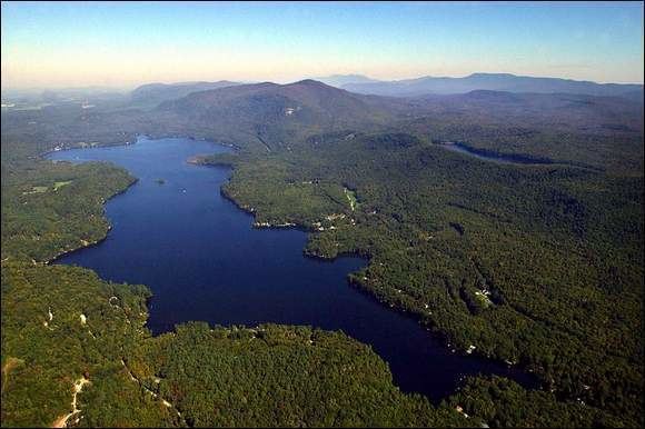
Lake Dunmore is a freshwater lake in Addison County, Vermont. The lake spans the towns of Salisbury and Leicester and has a surface area of 985 acres (3.98 km2). Lake Dunmore is over 3 miles long (oriented north-south) and up to 1 mile wide. The primary source of water is Sucker Brook, which rises in the adjacent Moosalamoo National Recreation Area of the Green Mountain National Forest. The lake is drained by Leicester River, a tributary to Otter Creek, which in turn empties into Lake Champlain.
Contents
Map of Lake Dunmore, Vermont, USA
Branbury State Park occupies 69 acres (28 hectares) of the eastern shore and offers a sandy beach, canoe rentals, and campsites. Vermont Route 53 follows the eastern and northern shores of the lake. Most of the shoreline is privately owned.
Although a natural lake formed by glaciation, the water level is controlled by a small dam. In addition, Sucker Brook is part of a hydroelectricity project connecting Silver Lake and Sugar Hill Reservoir via Sucker Brook and operated by Green Mountain Power.