
Primary outflows Grey River Surface elevation 655 m Shore length 8.9 km | Area 2.6 km² Outflow location Grey River | |
 | ||
Surface area 2.6 square kilometres (1.0 sq mi) | ||
2014 lake christabel track
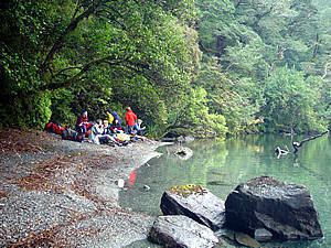
Lake Christabel is a small lake in the north of New Zealand's South Island. It is located 12 kilometres southwest of the Lewis Pass. The lake is the source of the Grey River, one of the longest rivers on the South Island's West Coast, although its outlet is underground. The lake lies behind a landslide dam, thought to have been created by a prehistoric earthquake.
Contents
- 2014 lake christabel track
- Map of Lake Christabel Victoria Forest Park 7895 New Zealand
- Lake christabel robinson river and saddle track lewis pass new zealand tramping s
- References
Map of Lake Christabel, Victoria Forest Park 7895, New Zealand
Lake christabel robinson river and saddle track lewis pass new zealand tramping s
References
Lake Christabel Wikipedia(Text) CC BY-SA