Basin countries Canada Max. width 1 km (0.62 mi) Length 14 km Province Ontario Outflow location Buckhorn Lake | Max. length 14 km (8.7 mi) Surface elevation 245 m Width 1 km Group Kawartha Lakes | |
 | ||
Primary outflows Harrington Narrows to Buckhorn Lake Islands Big Island, Goat Island, Kelly Island | ||
Fishing on lake chemong
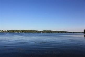
Lake Chemong, or Chemong Lake, (pronounced "shi-MONG, from the anisnaabemowin gchi-maang, meaning "big lake")" is a lake 8 km NW of Peterborough, Ontario near the town of Bridgenorth. The lake extends from near Fowlers Corners north to near Curve Lake. Lake Chemong has a length of 14 km and a width of 1 km.
Contents
- Fishing on lake chemong
- Map of Chemong Lake Ontario Canada
- Musky fishing in lake chemong
- CommunitiesEdit
- Tri lake water systemEdit
- Kawartha lakes water systemEdit
- Lake islandsEdit
- Name historyEdit
- References
Map of Chemong Lake, Ontario, Canada
Musky fishing in lake chemong
CommunitiesEdit
Communities along and near the lakeshore include Bridgenorth, Selwyn on the east, and Ennismore on the west. There is a causeway which crosses the lake, connecting Bridgenorth and Ennismore by road. This causeway is called the James A. Gifford Causeway.
Tri-lake water systemEdit
Chemong Lake is part of a tri-lake water system consisting of Chemong Lake, Buckhorn Lake, and Pigeon Lake. The tri-lake area is host to several popular fishing tournaments throughout the open fishing season. The most common game fish in the lake are smallmouth bass, largemouth bass, walleye, yellow perch, Carp, Muskellunge as well as a number of Panfish. Commercial and recreational fishing has caused the introduction of Zebra mussels, which change the ecosystem by filtering the water and making it clearer. Some fish, such as Walleye, dislike the clear water and have become less abundant.
Kawartha lakes water systemEdit
Chemong is also a part of the Kawartha lakes water system and the Trent-Severn Waterway.
Lake islandsEdit
There are a number of small islands on the lake, including Big Island, Goat Island and Kelly Island. Most of the islands have cottages or are commonly used as impromptu campsites. Rocky shoals surround these islands - boaters should approach with care.
Name historyEdit
Although still commonly called 'Chemong Lake', the official spelling has been changed to the more accurate 'Chemung' at the request of members of the local native community. The name means "Mud Lake", referring to the swampy conditions of the area before it was intentionally flooded during the creation of the Trent-Severn Waterway.
