
Max. length 1.5 mi (2.4 km) Average depth 10.7 ft (3.3 m) Area 66 ha Catchment area 6.839 km² Inflow source Assabet River | Surface area 163 acres (66 ha) Max. depth 23 ft (7.0 m) Mean depth 3.26 m Outflow location Assabet River | |
 | ||
Similar Assabet River National, Pine Bluff Recreational Area, Sudbury Reservoir, Lake Cochituate, Weston Reservoir | ||
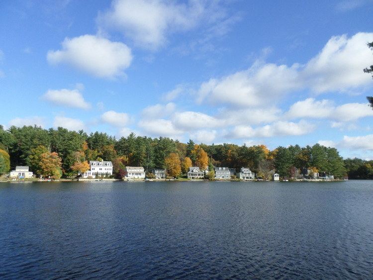
Lake Boon is a lake in eastern Massachusetts covering about 163 acres (0.66 km2) in the towns of Stow and Hudson, Massachusetts. It has been an important part of the Stow and Hudson communities since the towns originated. It was originally named Boon Pond after Matthew Boon, an explorer from Charlestown, Massachusetts who came to the area in 1660. He was the first of two settlers in Stow and was killed by Native Americans near the Lake on about February 14, 1676. In 1883 a monument was erected in memory of him.
Contents
Map of Lake Boon, Stow, MA 01775, USA
ExpansionEdit
The lake consists of four basins. The first basin made up the original part of the lake. It is the largest basin of the four and stretches from "the Narrows" to the dam on Barton Road in Stow. It is the only part of the lake that is completely in Stow. In 1847 the water rights to Boon Pond were purchased by Amory Maynard and a dam was built to increase the size of the pond. The intent was to add to the water reserve needed to provide continuous water power to the Assabet Woolen Mill, in the town of Maynard. Thus, in the early years the pond would be large after the spring melt, then shrink as water was let out during the summer months. Once the woolen mill converted to coal-fired steam power the need for Lake Boon's water was ended, and a more permanent water level was established.
The expansion went into the Ramshorn Meadow and the Ramshorn Swamp. The meadow area is now known as the second basin, while the swamp area is known as the third and fourth basins. The expansion helped locals to recognize this body of water no longer as a pond, but as a lake. Boon Lake is now 163 acres (0.66 km2) in size and one and a half miles long. Maximum depth of the first basin is 23 ft (7.0 m), the deepest part of the lake. The second basin is only 10 ft (3.0 m) deep, the third basin is a mere 7 ft (2.1 m) deep, and the fourth basin is 4 ft (1.2 m) deep.
Golden ageEdit
Lake Boon became a popular summer spot towards the end of the 1800s. It was easily accessible because of two railroad lines that ran by it. These railroad lines came out of Boston, which made the lake a great summer spot for city dwellers. At this time Lake Boon had a hotel, many clubs, two post offices, churches, and local stores.
In order to get from the railroad stops to the lake's hot spots, a ferry service was put into action. The steamship Cleo created a ferry line around 1900 that went from two points: Whitman’s Crossing near the Sudbury Rd bridge in Stow, and the Ordway Station in Hudson. In 1910, a gas-powered ferry called the Princess replaced the Cleo.
The entrance of automobiles into the economy made it easier for people to travel long distances. Therefore, Lake Boon as a vacation spot became obsolete, and made way for permanent residents to live there, instead of only vacationing. With the lack of visitors and increase in residents, the hotel was shut down.
PresentEdit
These days Lake Boon serves as a very important part of the Stow and Hudson communities. In the summer it provides a place for camps and swim lessons. The town beach, Pine Bluffs, located in Stow on the first basin, recently installed new picnic tables and grills to attract families to come and the spend the day. Use of the Pine Bluff Beach requires a pass. Residents and non-residents can purchase a season pass; only residents can purchase a day pass.