
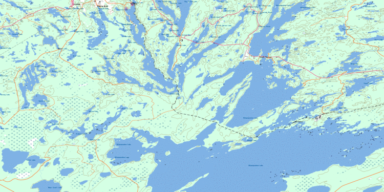
Max. width 35.2 km (21.9 mi) Surface elevation 291 m Width 35.2 km Outflow location Goose River | Primary outflows Goose River Max. length 31.2 km (19.4 mi) Area 269 km² Length 31.2 km Shore length 786 km | |
 | ||
River sources Pineroot River, Mistik Creek, Schist Creek, Flintoba Creek | ||
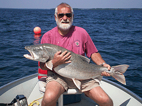
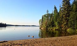
Lake trout on lake athapapuskow on fishing saskatchewan
Lake Athapapuskow is a glacial lake located 15 km (9.3 mi) southeast of Flin Flon, Manitoba, Canada, straddling the Manitoba and Saskatchewan border.
Contents
- Lake trout on lake athapapuskow on fishing saskatchewan
- Trophy walleye on lake athapapuskow on fishing saskatchewan
- Description
- History
- Islands
- References
Trophy walleye on lake athapapuskow on fishing saskatchewan
Description
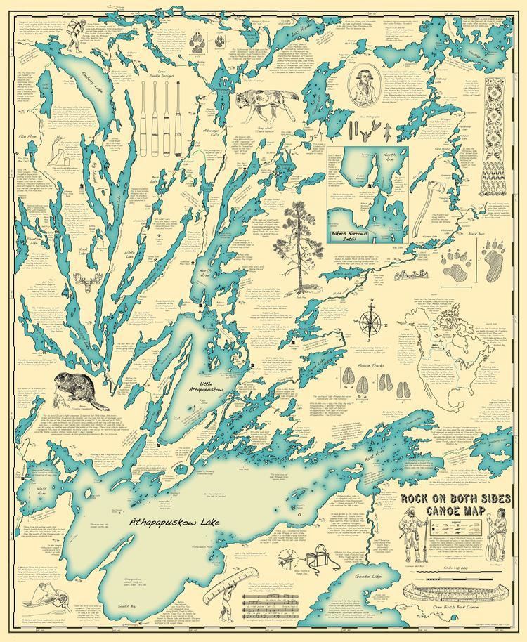
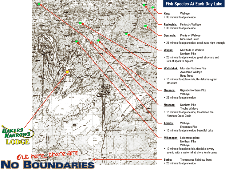
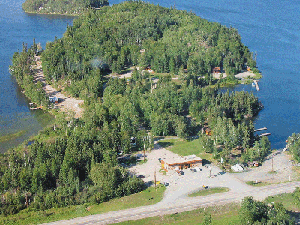
Lake Athapapuskow consists of three connected bodies of water, "Big Athapap" to the south, "Little Athapap" in the middle, and the "North Arm". There are three communities on the lake, Cranberry Portage on the southeast end, Millwater on the north shore of "Big Athapap", and Bakers Narrows between the "Little Athapap" and the "North Arm". The Flin Flon Airport is located on the north shore of "Little Athapap". Bakers Narrows Provincial Park straddles the narrows between the North Arm and Little Athapap. There are several fishing lodges located on the lake.
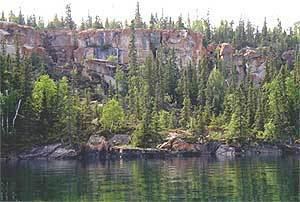
The lake is surrounded by Precambrian boreal forest, a mixed forest of coniferous and deciduous trees of the Canadian Shield. The area contains stands of black spruce, jack pine, white spruce, and trembling aspen. It drains via the Goose River (also known locally as the Rat River), and is part of the Nelson River basin.
Fish species include walleye, yellow perch, northern pike, lake trout, lake whitefish, burbot, rainbow trout, white sucker, Tullibee, splake and small mouth bass. The lake is well known for its sport fishing and has held three world records to date. In 1937, Leone Grayson caught a world record Lake Trout off Gull Island, a feat recorded in a memorial cairn at the Bakers Narrows Campground.
History
The area has been inhabited since prehistoric times. Archaeological digs at Bakers Narrows revealed pottery, arrowheads, and other artifacts which were at least 2,500 years old and indicated regular habitation by the "Shield Archaic Culture", who hunted caribou in the area as far back as 7000 years ago. They were eventually supplanted by the Woodland Cree who were nomadic hunters in this region. The site of Cranberry Portage has been the primary route linking the Grass River and Saskatchewan River watersheds for at least 2,000 years.
Many of the most important explorers in Canadian history travelled through Lake Athapapuskow. In 1763, Hudson's Bay Company explorers Joseph Smith and Isaac Batt, guided by Cree leader Meesinkeeshick, became the first European recorded to visit Lake Athapapuskow; Smith died on the return journey to York Factory. Ten years later, the Governor of Churchill sent the fur trader Joseph Hansom, also guided by Cree, inland to extend the reach of the HBC. He paddled from Lake Kississing down the Pineroot River, reaching Lake Athapapuskow. In 1774, the explorer Samuel Hearne with 2 Englishmen, 6 native guides, and 5 canoes, laden with "180 lbs. Brazil Tobacco, 130 lbs. Powder, 100 wt. of Shott & Ball, 6 Gallns Brandy and some other trifling articles of Trading goods" paddled up the Grass River to Cranberry Portage and into Lake Athapapuskow en route to establishing Cumberland House. This route became an important part of the North American fur trade, known as the "Upper Tract". It was abandoned by 1800 in favour of the Nelson River and Hayes River routes. In 1794, the fur-trader and cartographer David Thompson, surveyed the lake.
The lake first appeared on a map drawn by Peter Pond in 1785 and was described as the "Middle Road to Hudson's Bay". The name of the lake was first noted In 1806, when explorer and surveyor Peter Fidler recorded the main waterways of his Cree partners in the notable "Cha Chay Pay Way Ti’s Map of the Waterways of a Part of Northern Manitoba", Cranberry Portage and Lake Athapapuskow are clearly marked on it. In 1896 J.B. Tyrell surveyed a portion of the south shore, but due to its remoteness, the lake was not fully mapped until 1914 when the Geological Survey of Canada sent Everend Bruce to do so in 1914.
After the discovery of ore at Flin Flon, the lake became an important transportation link. During the First World War, ore from the Mandy Mine on Schist Lake, was barged across Lake Athapapuskow on the stern-wheeler S.S. Tonapah on its way to The Pas where it was then shipped by rail for smelting. In 1917 a road first reached the south shore from Sturgeon Landing and in 1928 the Hudson Bay Railway reached Cranberry Portage. The town of Cranberry Portage itself was established on the southeast arm of the lake in 1922 when William Thompson built a house there. Manitoba Highway 10 reached Cranberry Portage in 1949 and was extended to Bakers Narrows in 1951. In 1961 Bakers Narrows Provincial Park was established on the lake. There are several fishing lodges located on the lake.
The name was officially registered in 1948 and is believed to be derived from "Athapa'puskow Saka'higan" meaning "rock on both sides lake" in Swampy Cree, which aptly describes the stony pre-Cambrian shores.
Islands
The lake has over 575 islands, most of them unnamed. Some of the named islands include: