
Surface area 4.71 km (1.82 sq mi) Surface elevation 1,805 m | Catchment area 295 km (114 sq mi) Max. depth 119 m (390 ft) Area 4.71 km² Outflow location Spöl | |
 | ||
Primary inflows Water volume 164.6×10^ m (5.81×10^ cu ft) | ||
Technical trailbiking to the lago di livigno italy 4k ultra hd
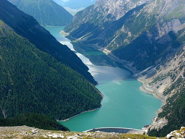
Lago di Livigno or Lago del Gallo is a reservoir in the Livigno valley. The reservoir is mostly in Italy whereas the Punt dal Gall arch dam is crossed by the border with Switzerland (Zernez, Grisons).
Contents
- Technical trailbiking to the lago di livigno italy 4k ultra hd
- Map of Lago di Livigno
- Ktm x bow lago di livigno gallery road
- References
Map of Lago di Livigno
The reservoir's surface area is 4.71 km².
The reservoir has a capacity of 164 million m³. Its minimum and maximum water levels above sea level are at 1,700 metres and 1,805 metres respectively. Since its construction, this reservoire had been off-limits for any activity, such as wind-surfing or rowing, until the summer of 2005, when Italy's National Rowing team was authorized to train on the lake.
Ktm x bow lago di livigno gallery road
References
Lago di Livigno Wikipedia(Text) CC BY-SA