
Primary inflows Basin countries Italy Surface elevation 969 m | Primary outflows Rio del Lago Surface area 1 km (0.39 sq mi) Area 100 ha | |
 | ||
Similar Predil Pass, Sella Nevea, Alps, Orrido dello Slizza, Mangart | ||
Friuli lago del predil l t di rabil full hd
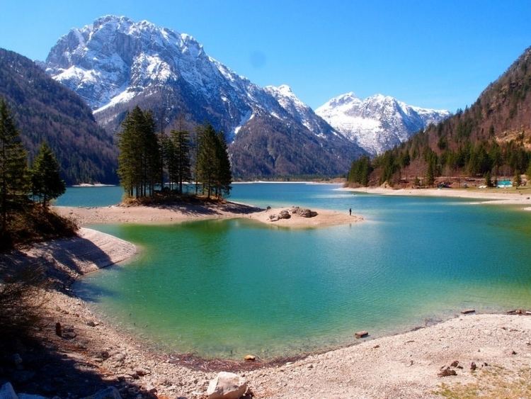
Lago del Predil (Friulian: Lât di Rabil, German: Raibler See, Slovene: Rabeljsko jezero) is a lake near Cave del Predil, part of the Tarvisio municipality in the Province of Udine, in the Italian region of Friuli-Venezia Giulia.
Contents
- Friuli lago del predil l t di rabil full hd
- Map of Lago del Predil 33018 Tarvisio Province of Udine Italy
- Lago del predil
- GeographyEdit
- HistoryEdit
- References
Map of Lago del Predil, 33018 Tarvisio, Province of Udine, Italy
Lago del predil
GeographyEdit
The lake is located at an elevation of 969 m (3,179 ft), situated in a high valley of the Julian Alps north of the Sella Nevea. In the east, the Predil Pass road leads up to the Slovenian border. With a surface area of about 1 km2 (0.39 sq mi), it is the second largest natural lake of the Friuli-Venezia Giulia region, after Lago di Cavazzo.
Due to its picturesque setting beneath the Kanin massif, the lake is a popular tourist destination for hikers and day trippers.
HistoryEdit
For centuries, the southern border of the Imperial Duchy of Carinthia with the Venetian Domini di Terraferma ran along the nearby mountain crests of Predil Pass and Sella Nevea. After the loss of the Venetian territory to the Kingdom of Italy in 1866, the Austro-Hungarian Army from 1885 to 1887 had a fortress erected on the lakeside, to protect the road down to Tarvisio.
In World War I, the fort was badly damaged during the Battles of the Isonzo on the Italian Front. Some ruins are preserved and accessibe to the public.