
Country Canada Time zone EST (UTC−5) Population 2,445 (2011) Province Québec | Constituted January 27, 1973 Postal code(s) J0T 1H0 Area 216.3 km² Local time Friday 11:01 AM Area code 819 | |
 | ||
Website www.municipalite.labelle.qc.ca Weather -10°C, Wind N at 8 km/h, 62% Humidity | ||
Adventurial memorable snowshoeing moments at centre de ski de fond de labelle quebec
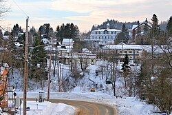
Labelle is a village and municipality in the Laurentides region of Quebec, Canada, part of the Les Laurentides Regional County Municipality. Its large "L"-shaped territory surrounds Lake Labelle, and the village is located along the Rouge River and Route 117.
Contents
- Adventurial memorable snowshoeing moments at centre de ski de fond de labelle quebec
- Map of Labelle QC Canada
- Demographics
- References
Map of Labelle, QC, Canada
Demographics
Population trend:
Private dwellings occupied by usual residents: 1115 (total dwellings: 1753)
Mother tongue:
References
Labelle, Quebec Wikipedia(Text) CC BY-SA