
Country Honduras Municipality since 1859 Population 6,640 (2015) | Department Lempira Area 83 km² | |
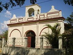 | ||
La Virtud ([la βirˈtuð]) is a municipality in the Honduran department of Lempira.
Contents
Map of La Virtud, Honduras
It is one of the municipalities of the Lempira department. It is also one of the furthest from the big cities in Honduras but near to El Salvador border. It takes up to 4 hours to get there taking either way of Gracias or Santa Rosa de Copán. However, the best way is via Santa Rosa de Copan-San Marcos de Ocotepeque-Cololaca-Valladolid-La Virtud.
History
The very first settlers were Spanish from El Salvador, seeking fields for sowing the raw material for bluing. It is believed that its founder was a priest called Doroteo Alvarenga in 1775. It was granted a municipality back in 1859.
Geography
The municipality capital is located in a valley and causing to decrease its elevation to sea level and the vegetations corresponds to the dry subtropical forest and the weather is hot throughout the year. Throughout the rest of the municipality there are some mountains and hills but the vegetation and weather are the same.
Boundaries
Its boundaries are:
Population
The majority of people is a cross-breed of native Indians and Spanish settlers, and there's a small amount of Indian descendants in the surrounding villages.
Tourism
It has the typical colonial Spanish distribution in the downtown area. Perhaps the best feature is going swimming in one the rivers nearby, one of those is the "Lempa" river on the border with El Salvador. For more information about hobbies and entertainment in this municipality go to the next link: La Virtud