
Country France Intercommunality Pays Sostranien Area 37.07 km² | Canton La Souterraine Population (2008) 5,435 Local time Friday 11:27 AM | |
 | ||
Weather 14°C, Wind E at 16 km/h, 68% Humidity | ||
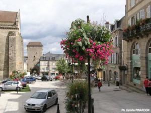
La Souterraine (Occitan: La Sotarrana) is a commune in the Creuse department in the Nouvelle-Aquitaine region in central France.
Contents
Map of 23300 La Souterraine, France
Geography
An area of farming and light industry comprising the town and a few small hamlets situated some 20 miles (32 km) west of Guéret at the junction of the D1, D912, D951 and the N145 roads. The small river Sédelle, a tributary of the Creuse River, flows through the town. It is also served by a TER railway link.
The Benaize, a tributary of the Anglin, has its source in the commune.
The Brame, a tributary of the Gartempe, has its source in the commune.
History
There is evidence of pre-Roman occupation here, attested by the discovery of stone age tools and a menhir. Remains of Roman villas and temples have been unearthed. In medieval times, a church and fortified walls were built. The name of the town, translating as ‘subterranean’, comes from the underground parts of the church, the crypt.