
Surface area 1.56 sq mi (4.05 km²) | Area 4.04 km² | |
 | ||
Similar Carite Lake, Guajataca Lake, Jesús Izcoa Moure Bri, Aguadilla Ice Skating Arena, Paseo Tablado La Guancha | ||
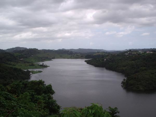
Lago La Plata is a lake located between the municipalities of Naranjito, Toa Alta, and Bayamón in Puerto Rico. The lake was created in 1973 and serves as a reservoir for potable water.
Map of Lago La Plata, Toa Alta 00953, Puerto Rico
The lake receives flow from the La Plata River and can be used for fishing.
References
La Plata Lake Wikipedia(Text) CC BY-SA