
Area 4.05 km² | Population (1999) 4,962 | |
 | ||
Canton La Grand-Croix(chef-lieu) Intercommunality Communauté d'agglomération Saint-Étienne Métropole | ||
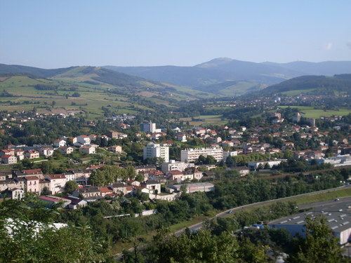
La Grand-Croix is a commune and a canton in the Loire department in central France. It lies in the Gier valley.
Contents
Map of La Grand-Croix, France
The commune is the main town of the canton of La Grand-Croix, Arrondissement of Saint-Étienne, department of Loire in the Auvergne-Rhône-Alpes region. The canton includes the towns of La Grand-Croix, Lorette, l'Horme, Cellieu, Chagnon, Farnay, Saint-Paul-en-Jarez, La Terrasse-sur-Dorlay, Doizieux and Valfleury. The commune has an area of 405 hectares (1,000 acres) and as of 2013 had just over 5,000 inhabitants. It lies on the A47 autoroute. Lyon is 40 kilometres (25 mi) to the east, and Saint-Étienne is 18 kilometres (11 mi) to the west. The commune is close to the Parc Naturel Régional du Pilat.
The Dorlay river, a tributary of the Gier that rises in Mont Pilat, forms the border between La Grand-Croix and Lorette.