Population (2006) 891 Local time Friday 1:05 AM | Region Île-de-France Area 25.06 km² Arrondissement Rambouillet | |
 | ||
Intercommunality Plaines et forêts d'Yveline Weather 10°C, Wind S at 0 km/h, 91% Humidity | ||
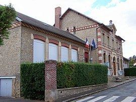
La Boissière-École is a commune in the Yvelines department in north-central France.
Contents
Map of La Boissi%C3%A8re-%C3%89cole, France
Géography
The village is located in the Southern West of Yvelines. The most part of the landscape is constituted of forest. The place is separated in two. The castle and the Olympe Hériot school are in "La Basse Boissière" but most of the inhabitants live in "La Haute Boissière". "La Gâtine" and "Mauzaize" are located in the west of the village centre. Lots of small village are located around this : "Adainville", "Condé-sur-Vesgre", "Poigny-la-Forêt", "Hermeray", "Mittainville", "La Hauteville". It can be reached by the 71 road and the 80.
Economy
In the east of the village, tourists can enjoy an equestrian centre. The principal activity of the village is a farmer : "La Tremblay".
