
Country India Area 49.73 km2 Region | ||
 | ||
Colleges and Universities Kurnool Medical College, Rayalaseema University, Silver Jubilee Government Degree College | ||
Map of Kurnool
Kurnool is a city, former princely state and the headquarters of Kurnool district in the Indian state of Andhra Pradesh. The city is often referred as The Gateway of Rayalaseema. It was the capital of Andhra State from 1 October 1953 to 31 October 1956. As of 2011 census, it is the fifth most populous city in the state with a population of 460,184.
Contents
- Map of Kurnool
- Andhra pradesh watch fight between police and traffic guard in kurnool city
- Etymology
- Palaeolithic era
- Early Feudal Era
- Mughal princely state
- Post independence
- Location
- Cityscape
- Climate
- Demographics
- Politics
- Education
- Roads
- Railways
- Airport In Kurnool
- Economy
- References
Andhra pradesh watch fight between police and traffic guard in kurnool city
Etymology
The name Kurnool is derived from Kandanavolu.
Palaeolithic era
The Ketavaram rock paintings from the Paleolithic era and are (18 kilometres from Kurnool). Also the Jurreru Valley, Katavani Kunta and Yaganti in Kurnool District have some important rock art and paintings in the vicinity, dated from 35,000 to 40,000 years ago.
Early Feudal Era
Little was known about Kurnool town before the 11th century. The earliest knowledge of this settlement dates from the 11th century. It has developed as transit place on the southern banks of the river Tungabhadra. It was ruled by Cholas and later by Kakatiya kings in the 12th and 13th centuries. Traces of ashes from the Paleolithic age are also found here.
During the 17th century it was ruled by Gopal Raja. The Pathan general Abdul Wahab conquered king Gopal Raja and ruled over the country for 16 years.
Mughal princely state
The town became a vassal princely state of the Mughal empire under Aurangazeb, who took control in 1686. The town was the capital and seat of ruling Muslim princes, styled Nawabs:
Post independence
The city served as the capital of Andhra State from 1953–1956, until in 1956, when the Telangana region was merged with Andhra State to form Andhra Pradesh state, and its capital was shifted from Kurnool to Hyderabad.
Location
Kurnool is located at 15.8333°N 78.05°E / 15.8333; 78.05. It has an average elevation of 273 metres (898 feet).
Kurnool lies on the banks of the Tungabhadra River. The Hundri and Neeva rivers also flow through the city. The K.C. Canal (Kurnool–Cuddapah) was built by the Dutch for transportation, but later used for irrigation.
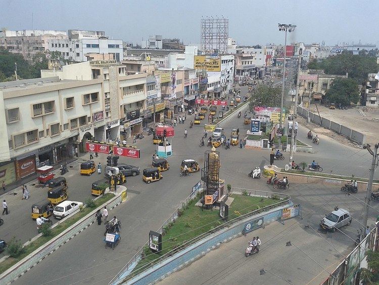
Cityscape
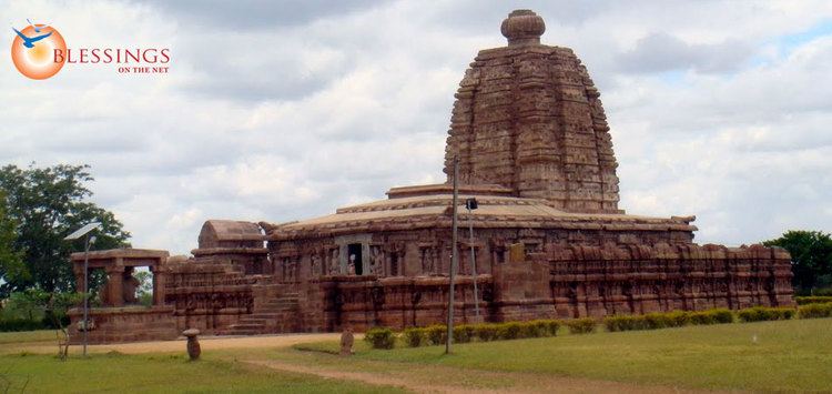
Landmarks in and around the city include Konda Reddy Fort (or Kondareddy Burj) is the remnant of Kurnool fort on the north east part of the city. Orvakal rock Garderns with a cave museum lies on the south east of the city.
Climate
The climate is tropical with temperatures ranging from 26 °C (78.8 °F) to 46 °C (114.8 °F) in the summer and 12 °C (53.6 °F) to 31 °C (87.8 °F) in the winter. The average annual rainfall is about 705 millimetres (28 in).
Demographics
As per final data of 2011 census, Kurnool urban agglomeration had a population of 484,327. The literacy rate was 77.37 per cent. note: The Office of Registrar General & Census Commissioner of India. note: UA = Urban Agglomeration.
Politics
The present MLA is S V Mohan Reddy.
Education
The primary and secondary school education is imparted by government, aided and private schools of the School Education Department of the state. The medium of instruction followed by different schools are English, Telugu.
There are good number of government and private educational institutions in the city. Some of the universities and colleges are:
Roads
Kurnool is well connected by road with State Capital Amaravathi. It is in halfway between [[Hyderabad and Bengaluru. National Highway 44 (India) connects Kurnool to Hyderabad. The State Highway 51 connects to Srisailam, Vinukonda, Guntur, Vijayawada. National Highway 40 (India) (new numbering) runs from Kurnool to Chittoor are the major highways passing through the city. The city has a total road length of 519.22 km State owned bus transport system, APSRTC, operates buses from Kurnool bus station to other parts of the state.
Railways
Kurnool railway station lies on the Hyderabad – Guntakal railway line. It is classified as an A–category station in the Hyderabad railway division of South Central Railway zone.
Airport In Kurnool
The Ministry of Civil Aviation has proposed to develop Kurnool Airport, a greenfield (no frills) airport near Orvakal, 25 km from Kurnool city. The airport in being built on 1,110 acres of land at a cost of Rs.234 crores and will be completed by mid July 2018
Economy
Kurnool is endowed with good mineral resources. The important minerals are Iron ore, Dolomite, lime stone, ochre, quartz stealite and silica.