
Population 16,357 (1 Jun 2016) | Region ChūgokuSan'in District Saihaku Local time Thursday 8:51 AM | |
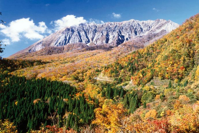 | ||
Time zone Japan Standard Time (UTC+9) Weather 5°C, Wind SW at 21 km/h, 75% Humidity Points of interest Mount Daisen, Daisen‑ji, Ogamiyama Shrine Okunomiya, Mukibanda Yayoi remains, Jūun‑ji Temple | ||
Daisen (大山町, Daisen-chō) is a town located in Saihaku District, Tottori Prefecture, Japan.
Contents
Map of Daisen, Saihaku District, Tottori Prefecture, Japan
As of January 1, 2011, Daisen had an estimated population of 17,241 and a population density of 90.84 persons per km². The total area is 189.79 square kilometres (73.28 sq mi). The town is known for Mount Daisen, the tallest mountain in the Chūgoku Region. The mountain was an early center of Shinto and Buddhist practice, and the town has numerous designated Cultural Properties of Japan.
Geography
Daisen is located to the west of Saihaku District. The north of the town has a broad coast along the Japan Sea, and its inland area sweeps up to the Chūgoku Region, specifically Mount Daisen. The Amida River flows north towards the Sea of Japan and forms an alluvial delta in Daisen.
History
The town of Daisen was formed from the merger of the towns of Nakayama and Nawa, both from Saihaku District, on March 28, 2005.
Sister city
The town is a sister city to Temecula, California.