
Time zone CET (UTC+1) Area 55.12 km² Population 618 (2015) | County Bács-Kiskun Postal code 6043 Local time Sunday 1:20 AM Area code 76 | |
 | ||
Weather 9°C, Wind W at 18 km/h, 80% Humidity | ||
Kunbaracs is a village in Bács-Kiskun county, in the district of Kecskemét city, in the Southern Great Plain region of southern Hungary. As of 2015, its population was 618, which makes it the smallest settlement in this area.
Contents
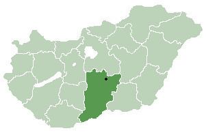
Map of Kunbaracs, 6043 Hungary
Geography
It covers an area of 55.12 km2 (21 sq mi). The village is 25 km from Kecskemét. The nearest towns are Lajosmizse and Kerekegyháza. The settlement is surrounded by woods, which mostly belong to the Kiskunság National Park.
Sights of the village
Northwest of the village is the "Red" manor-house, which is protected as an art memorial. It was named after its red-tiled roof. The oldest part of the building is the arched hall at the first ground, probably built around 1780. Its original function was possibly a cattle or sheep barn.
Its first owner was the Teleky family, and later the Zeyk family.
In the 1990s the building was totally destroyed. The restoration was completed in 2000. However, the style is different from the original.