
Time zone MST (UTC-7) Elevation 23 m Population 1,491 (2016) Area code 867 | Electoral district Kugluktuk Canadian Postal code X0B 0E0 Area 549.6 km² Local time Saturday 1:07 PM Number of airports 1 | |
 | ||
Weather -21°C, Wind W at 39 km/h, 77% Humidity | ||
Pushing for change in kugluktuk
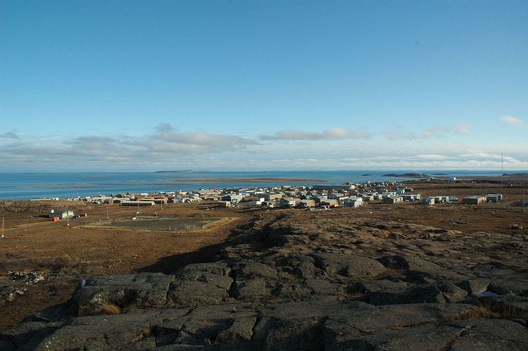
Kugluktuk (Inuinnaqtun: Qurluktuk, "the place of moving water"; Inuktitut: ᖁᕐᓗᖅᑐᖅ, formerly Coppermine until 1 January 1996) is a hamlet located at the mouth of the Coppermine River in the Kitikmeot Region of Nunavut, Canada, on Coronation Gulf, southwest of Victoria Island. It is the westernmost community in Nunavut, near the border with the Northwest Territories.
Contents
- Pushing for change in kugluktuk
- Map of Kugluktuk NU Canada
- Kugluktuk climate change adaptation project
- Location
- Demographics
- Geography
- Flora and fauna
- Climate
- References
Map of Kugluktuk, NU, Canada
The traditional language of the area is Inuinnaqtun and is written using the Latin alphabet, rather than the syllabics of the Inuktitut writing system. Like Cambridge Bay, Bathurst Inlet, and Umingmaktok, syllabics are rarely seen and are used mainly by the Government of Nunavut.
Kugluktuk climate change adaptation project
Location
The community has the usual services: a post office, Northern Store, co-op store, and Hunters & Trappers Association. The two schools in the area are Kugluktuk High School and Jimmy Hikok Ilihakvik. In June 2004, a fuel line broke in the center of Kugluktuk, spilling 2,000 L (439.9 imp gal; 528.3 US gal) of diesel fuel.
Demographics
At the 2016 census, the population was 1,491, an increase of 2.8% from the 2011 census. The Population centre showed a population of 1,057, in an area of 0.34 km2 (0.13 sq mi), an increase of 1% from 2011.
In 1982, a division plebiscite was held. While approximately 80% of the population in what is now Nunavut voted in favour of division, Coppermine was one of only two communities to vote against division. Cambridge Bay was the other.
Geography
Kugluktuk is located on the shore of the Arctic Ocean. The surrounding landscape is dominated by the rocky and often barren Canadian Shield. The region has a subarctic climate, but barely so, with July having an average of 10.7 °C (51.3 °F). It has very cold winters, light snowfall, and summers too cool to permit the growth of trees. Though trees do exist in the region, they are dwarfed and extremely sparse.
Flora and fauna
Plant growth in the region during summer months includes small shrubs, grass, moss, lichens, blueberries, blackberries, cranberries, various flowers, and dwarfed willow and birch trees.
Climate
Kugluktuk's climate, when classified according to the Köppen Climate Classification, belongs to the Dfc variant of a subarctic climate.). It is in the transitional zone to a Arctic Tundra (ET) Climate, but falls outside of it, since its warmest month of July surpasses the 50 °F (10 °C) isoterm, averaging 10.9 °C. Tundra climates are characterized by sub-freezing mean annual temperatures, large annual temperature ranges, and moderately low precipitation.
The highest temperature ever recorded in Kugluktuk was 34.9 °C (94.8 °F) on 15 July 1989. The coldest temperature ever recorded was −50.0 °C (−58 °F) on 2 February 1968.