
Coastline 20.38 km (12.664 mi) Highest point Maedake Elevation 628 m | Highest elevation 628.5 m (2,062 ft) Population 140 (2004) Area 13.33 km² | |
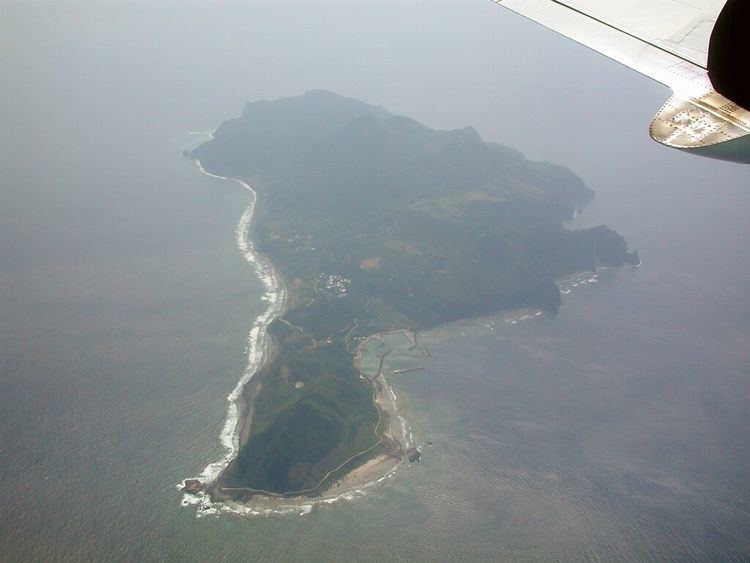 | ||
kuchinoshima sea
Kuchinoshima (口之島), literally "mouth island", is one of the Tokara Islands, belonging to Kagoshima Prefecture. The island, 13.33 km² in area, and has a population of 140 persons. The island can only be reached by boat as it has no airport, there are regular ferry service to the city of Kagoshima on the mainland. Travel time is about 6 hours. The islanders are dependent mainly on agriculture, fishing and seasonal tourism. The island is home to the rare Kuchinoshima breed of Japanese native cattle.
Contents
- kuchinoshima sea
- Map of Kuchinoshima Toshima Kagoshima District Kagoshima Prefecture 891 5101 Japan
- Geography
- History
- References
Map of Kuchinoshima, Toshima, Kagoshima District, Kagoshima Prefecture 891-5101, Japan
Geography
Kuchinoshima is the northernmost inhabited island in the Tokara archipelago, and is located 10 kilometres (5.4 nmi) northeast from Nakanoshima. The highest elevation is Maedake (前岳) located in the eastern part of the island, with a height of 628.5 metres (2,062 ft) above sea level. Maedake, Moedake (燃岳) in the northern part of the island at 425 metres (1,394 ft), and Yokodake (横岳) in the western part of the island at 500 metres (1,600 ft), are the three volcanos which make up the island. Although there has been no eruption recorded in historical times, Moedake emits steam, and discoloration of the ocean in nearby waters in 2001 indicates ongoing volcanic activity. The local climate is classified as subtropical, with a rainy season from May through September.
History
The island was once part of the Ryukyu Kingdom. During the Edo period, Kuchinoshima was part of Satsuma Domain and was administered as part of Kawanabe District. In 1896, the island was transferred to the administrative control of Ōshima District, Kagoshima, and from 1911 was administered as part of the village of Toshima, Kagoshima. From 1946 to 1952, the island was administered by the United States as part of the Provisional Government of Northern Ryukyu Islands.
The island is home to a small and critically-endangered population of feral cattle, the Kuchinoshima (Kuchinoshima-Ushi) breed, which – with the Mishima breed – is one of two remaining breeds of Japanese native cattle. Kuchinoshima cattle is not the only feral cattle in Japan as there is a small group of feral cattle on Kazura Island next to Naru Island.