
 | ||
The Kubang Pasu District is a district and a parliamentary constituency in northern Kedah, Malaysia. It contains the border town of Bukit Kayu Hitam, while Jitra is the largest settlement here.
Contents
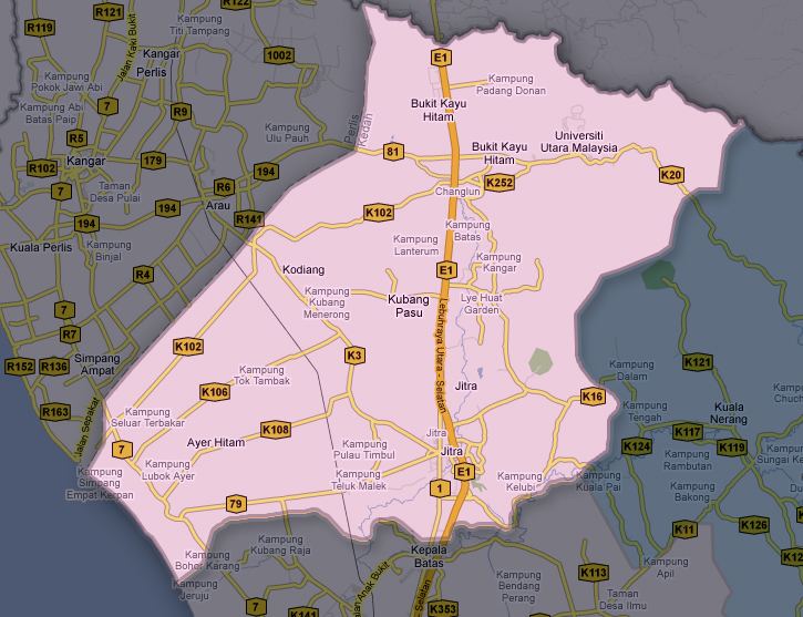
Map of Kubang Pasu, Kedah, Malaysia
History
Kubang Pasu was the semi-independent Malay State of Kubang Pasu Darul Qiyam, ruled by Phaya or King Tunku Anom Prince of Kedah.
Geography
The district spans over an area of 948 km2. To the west it borders Perlis, while its northern boundary forms part of the Malaysia-Thailand border. From east to south, in clockwise order, are the constituencies of Padang Terap, Pokok Sena and Kuala Kedah.
Administrative divisions
Kubang Pasu District is divided into 20 mukims, which are:
Education
The district is also known as Education Valley in Kedah because there is a concentration of educational institutions in Kubang Pasu. They are Universiti Utara Malaysia, Polytechnic of Sultan Abdul Halim Mu'adzam Shah, Industrial Training Institute (ILP), Bandar Darulaman Community College (Kolej Komuniti Bandar Darulaman), Akademi Binaan Malaysia (ABM), Institut Kemahiran Belia Negara (IKBS) and others.