
Admin. region Köln Time zone CET/CEST (UTC+1/+2) Local time Saturday 8:13 AM Postal code 52372 | Area 41.77 km² Population 17,717 (31 Dec 2010) | |
 | ||
Elevation 142 - 360 m (−1,039 ft) Weather 8°C, Wind W at 34 km/h, 91% Humidity | ||
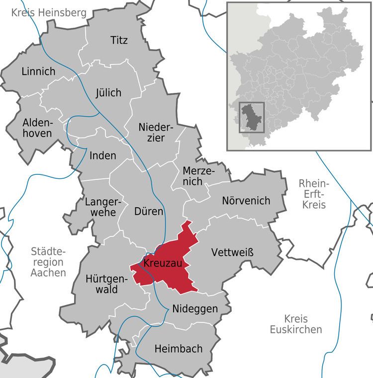
Kreuzau is a municipality in the district of Düren in the state of North Rhine-Westphalia, Germany. It is located on the river Rur, approx. 5 km south of Düren.
Contents
Map of 52372 Kreuzau, Germany
Neighbouring communities
Kreuzau is surrounded by the following settlements, listed clockwise beginning in the north: the county town of Düren and the municipalities of Nörvenich, Vettweiß, Nideggen and Hürtgenwald, all in the county of Düren.
Municipal subdivisions
The municipality Kreuzau includes the following civil parishes (Ortsteil):
In addition there was the now extinct village of Hemgenberg.
Twin towns
Kreuzau is twinned with:
References
Kreuzau Wikipedia(Text) CC BY-SA