
Coat of arms Flag Rural localities 33 Founded 1928 | Urban-type settlements 1 Area 479.2 km² | |
 | ||
Administrative center settlement of Krasnaya Yaruga | ||
Krasnoyaruzhsky District (Russian: Краснояружский райо́н) is an administrative district (raion), one of the twenty-one in Belgorod Oblast, Russia. Municipally, it is incorporated as Krasnoyaruzhsky Municipal District. It is located in the west of the oblast. The area of the district is 479.2 square kilometers (185.0 sq mi). Its administrative center is the urban locality (a settlement) of Krasnaya Yaruga. Population: 14,891 (2010 Census); 15,128 (2002 Census). The population of Krasnaya Yaruga accounts for 53.9% of the district's total population.
Contents
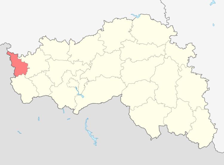
Map of Krasnoyaruzhsky District, Belgorod Oblast, Russia
Geography
Krasnoyaruzhsky District sits at the western edge of Belgorod Oblast, on the border with Ukraine. It is bordered on the south by Grayvoronsky District, on the west by Sumy Oblast in Ukraine, on the north by Belovsky District, Kursk Oblast, and on the east by Rakityansky District. The administrative center of the district is the town of Krasnaya Yaruga. The district is 50 km west of the city of Belgorod, and is 55 km northwest of the Ukrainian city of Kharkiv.
The terrain is hilly plain averaging 200 meters above sea level; the district lies on the Orel-Kursk plateau of the Central Russian Upland.