
Postal index 17000—17085 Population 46,193 (2015) | Established March 7, 1923 Time zone EET (UTC+2) Area 2,660 km² Area code 4646 | |
 | ||
Subdivisions List 1 — city councils 2 — settlement councils40 — rural councilsNumber of localities: 1 — cities 2 — urban-type settlements106 — villages 2 — rural settlements | ||
Kozelets Raion (Ukrainian: Козелецький район, Kozelets'kyi raion) is one of the 22 administrative raions (a district) of Chernihiv Oblast in northern Ukraine. Its administrative center is located at the urban-type settlement of Kozelets. Its population was 61,636 in the 2001 Ukrainian Census. Current population: 46,193 (2015 est.)
Contents
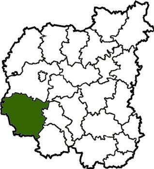
- Map of Kozeletskyi district Chernihiv Oblast Ukraine
- Geography
- History
- Administrative divisions
- Places of interest
- References
Map of Kozelets'kyi district, Chernihiv Oblast, Ukraine
Geography
The Kozelets Raion is located in the southwestern part of the Chernihiv Oblast, corresponding to the modern-day boundaries of the Polissia historical regions. To its west and south, it borders upon the Vyshhorod and Brovary Raions of the Kiev Oblast. Its total area constitutes 2,660 square kilometres (1,030 sq mi), constituting 8.3 percent of the total area.
History
As part of a full-scale administrative reorganization of the Ukrainian Soviet Socialist Republic, the Oster Raion was created on March 7, 1923, as an administrative entity of the Nizhyn Okruha; later in July of that year, the Kozelets Raion was also created. During the Holodomor, 508 people died throughout 36 settlements in the Kozelets Raion.
Administrative divisions
The Kozelets Raion is divided in a way that follows the general administrative scheme in Ukraine. Local government is also organized along a similar scheme nationwide. Consequently, raions are subdivided into councils, which are the prime level of administrative division in the country.
Each of the raion's urban localities administer their own councils, often containing a few other villages within its jurisdiction. However, only a handful of rural localities are organized into councils, which also may contain a few villages within its jurisdiction.
Accordingly, the Kozelets Raion is divided into:
Overall, the raion has a total of 111 populated localities, consisting of one city, two urban-type settlements, 106 villages, and 2 rural settlements.