
Population 17,219 (1 Jun 2016) | Region ChūgokuSan'in Local time Saturday 5:33 AM | |
 | ||
Time zone Japan Standard Time (UTC+9) Weather 2°C, Wind S at 3 km/h, 84% Humidity Points of interest Senjosan, Mt Karasugasen, Nikkanyuko Museum, Senjosanmanhonsakura Park | ||
Exploring yonago city tottori japan
Kotoura (琴浦町, Kotoura-chō) is a town located in Tōhaku District, Tottori Prefecture, Japan.
Contents
- Exploring yonago city tottori japan
- Map of Kotoura Tohaku District Tottori Prefecture Japan
- Etymology
- History
- Geography
- Bordering municipalities
- Rail
- Bus
- Highways
- Notables places
- References
Map of Kotoura, Tohaku District, Tottori Prefecture, Japan
As of February 2, 2012, the town had an estimated population of 18,183 and a population density of 130 per km². The total area is 139.90 square kilometres (54.02 sq mi).
Etymology
The name of Kotoura in Japanese is formed from two kanji. The first, 琴, refers to the traditional Japanese 13-string musical instrument, and the second, 浦 means "cove". The name of the town is taken from a stretch of the coast on the Japan Sea called Koto-no-ura (琴ノ浦).
History
Kotoura has been settled since ancient times. A dōtaku bronze bell was unearthed in Yabase district, one of only 400 in Japan, and a bronze sword was unearthed in Tagoshi district. Both items are from the Yayoi period (300 BC–250 AD), and both suggest a prosperous settlement in Kotoura in this period. The diary of Fujiwara no Sanesuke (957–1046), published as the Shōyūki describe rich pastures in the area during the Heian period (794–1185). Kotoura was used after this period as a center for animal husbandry; many new species of farm animals emerged from the area. In the Edo period (1603–1868) the karō of Tottori Domain resided in Kotoura, and supported a thriving market in the Urayasu district.
Kotoura was formed on September 1, 2004 by the merger of the towns of Tōhaku and Akasaki, both from Tōhaku District.
Geography
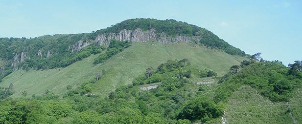
To the north Kotoura has a broad coast along the Japan Sea, while the southern part of the city rises to the Chūgoku Mountains. Mount Senjō, to the southwest of the town, is within the Mount Daisen range.
Bordering municipalities
Kotoura borders on four other municipalities in Tottori Prefecture.
Rail
Kotoura is served by the JR West San'in Main Line, specifically the segment that runs between the city of Tottori and Masuda, Shimane Prefecture.