
Country Japan City hall address 東陽4-11-28
135-8383 Area 40.16 km² Region Kantō region Team Keishichou Eagles | Prefecture Tokyo Website www.city.koto.lg.jp Population 488,632 (1 May 2015) Mayor Takaaki Yamazaki | |
 | ||
Time zone Japan Standard Time (UTC+9) Points of interest Museum of Contemporary Art - Tokyo, Miraikan, Kidzania Tokyo, Ooedo‑Onsen‑Monogatari, Tomioka Hachiman Shrine Colleges and Universities Shibaura Institute of Technology, Shiritsutokyoariakeiryo University, Ariake Junior College o | ||
Koto (江東区, Kōtō-ku, "East of River") is a special ward located in Tokyo Metropolis, Japan. The ward refers to itself as Kōtō City in English.
Contents
- Map of Koto Tokyo Japan
- Etymology
- Geography
- History
- Districts
- Rail
- Highway
- Air
- Economy
- Government
- Notable places
- Colleges and universities
- Primary and secondary schools
- International schools
- International relations
- References
Map of Koto, Tokyo, Japan
As of May 1, 2015, the ward has an estimated population of 488,632 and a population density of 12,170 persons per km². The total area is 40.16 km².
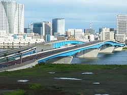
Kōtō is located east of the Tokyo metropolitan center, bounded by the Sumida-gawa to the west and the Arakawa River to the east. Its major districts include Kameido, Kiba, Kiyosumi, Monzen-nakachō, Shirakawa, and Toyosu. The waterfront area of Ariake is in Kōtō, as is part of Odaiba.
Etymology
"Koto" means "East of River" in Japanese.
Geography
Kōtō occupies a position on the waterfront of Tokyo Bay sandwiched between the wards of Chūō and Edogawa. Its inland boundary is with Sumida. Much of the land is reclaimed, so there are few old temples or shrines.
Noteworthy places in Kōtō include:
History
The western part of the ward was formerly part of Fukagawa Ward of Tokyo City. It suffered severe damage in the 1923 Great Kantō earthquake, and was heavily bombed during World War II.
The special ward was founded on March 15, 1947 by the merger of the wards of Fukagawa and Jōtō.
Districts
There are 45 districts in Koto:
Rail
Highway
Air
Economy
Companies with headquarters in Koto include Daimaru Matsuzakaya Department Stores, Ibex Airlines, Fujikura, and Maruha Nichiro.
Sony operates the Ariake Business Center in Kōtō. The broadcasting center of WOWOW is in Koto.
Seta Corporation was headquartered in Kōtō.
Government
The main city office for Koto City is located in Toyo. There are branch offices located in Shirakawa, Tomioka, Toyosu, Komatsubashi, Kameido, Ojima, Sunamachi and Minamisuna.
Notable places
Colleges and universities
Primary and secondary schools
Public elementary and middle schools are operated by the Koto City Board of Education. Public high schools are operated by the Tokyo Metropolitan Government Board of Education.
International schools
International schools are independently owned and operated.
International relations
As of April 20, 1989, Kōtō became the Sister City of Surrey, British Columbia, Canada.