
Major highways 1 Area 6,604 km² | Tehsils 5 Website Official website Tehsil 5 | |
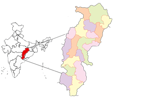 | ||
Koriya district, also commonly spelled as Korea district, is a district in the north-western part of the Chhattisgarh state in Central India. The administrative headquarters of the district is Baikunthpur.
Contents
- Map of Koriya Chhattisgarh
- History
- Geography
- Divisions
- Demographics
- Languages
- Culture
- Tourist places
- References
Map of Koriya, Chhattisgarh
History
Little is known of the area before the 16th century. Koriya was a princely state of British Empire in India; the other princely state that lay within the Koriya district was Chang Bhakar. After Indian Independence in 1947, the rulers of Koriya and Chang Bhakar acceded to the Union of India on 1 January 1948 and both were made part of Surguja District of Madhya Pradesh state.
The district of Koriya came into existence on May 25, 1998, when it was carved out of Surguja district. After the formation of the new state of Chhattisgarh on November 1, 2000, Koriya District became part of the new state. It is currently a part of the Red Corridor.
Geography
Koriya District lies between 22°56′ and 23°48′ North and 81°56′ and 82°47′ East. It is bounded on the north by Sidhi District of Madhya Pradesh, on the south by Korba District, on the east by Surguja District, and on the west by Anuppur District of Madhya Pradesh. The area of the district is 5977 km², of which 59.9% is forest area. The district is a vast mass of hill ranges. The general height of the lower tableland is 550 m (1800 feet) above sea level. The Sonhat Plateau has a maximum elevation of 755 m (2477 feet). The highest peak in the district is Deogarh, which is 1027 m (3370 feet) high.
The climate is mild with a bountiful monsoon, a mild summer and a bearable winter.
Divisions
Koriya District consists of five subdivisions of Baikunthpur, Bharatpur, Chirmiri, Manendragarh and Sonhat; five tehsils and five Blocks of Baikunthpur, Bharatpur, Khadgawan, Manendragarh and Sonhat and a Municipal corporation of Chirimiri . The district encompasses 653 villages, 5 Janpad Panchayats, 236 garam Panchayats, 2 Nagar Panchayats and 3 municipality.
Demographics
According to the 2011 census Koriya district has a population of 659,039, roughly equal to the nation of Montenegro or the US state of Vermont. This gives it a ranking of 510th in India (out of a total of 640). The district has a population density of 100 inhabitants per square kilometre (260/sq mi) . Its population growth rate over the decade 2001-2011 was 12.4%. Korea has a sex ratio of 971 females for every 1000 males, and a literacy rate of 71.41%.
According to the 2001 census, the total population of the district was 586,327 out of which 51.38% were male and 48.62% were female, 70.2% of this population was rural and 29.8% were urban, 8.2% belonged to the scheduled castes and 44.4% belonged to the scheduled tribes. Literacy rate was 63.1%, the male literacy rate being 75.7% and female literacy being 49.7%.
The original inhabitants of Korea district were the Kols, Gonds and Bhuinhars (Pando). All other communities in the district claim to have come from outside the district. Migration into Korea District was a continuous process. These migrants include the Cherva, Rajwars, Sahu, Ahir, Gwalas, Oraon, Gadaria (Gaderi), Koir, Bargah, Basods, Muslims, Kahars, Kunbi, Kewats, Guptas, Jaiswal, Schedule Caste, Agrawals, and Jains, and panika.
Languages
Tongues spoken in Koriya include Bagheli, which has a lexical similarity of 72-91% with Hindi (compared to 60% for German and English) and is spoken by about 7,800,000 people in Bagelkhand.
Culture
Three community dances, the Karma, Saila and Suga Dance are celebrated mainly in the district during different festivals. The main festivals of India such as Diwali, Dashehra and Holi are also celebrated in Korea District. Some other festivals are also special among the Korean communities, such as Ganga Dashera, Charta, Navakhai and Surhul. http://korea.gov.in/culture.htm
Tourist places
Main tourist places in the district are as follows: