
Country India District Pune Time zone IST (UTC+5:30) Population 8,999 (2001) Government body Gram panchayat | State Maharashtra Taluka Shirur Website maharashtra.gov.in Local time Friday 5:32 PM ISO 3166 code ISO 3166-2:IN | |
 | ||
Weather 34°C, Wind W at 18 km/h, 14% Humidity Similar Pune district, Lonikand, Pimpri Chinchwad | ||
Koregaon Bhima is a panchayat village and census town in the state of Maharashtra, India, on the left (north) bank of the Bhima River. Administratively, Koregaon Bhima is under Shirur Taluka of Pune District in Maharashtra. There is only the single town of Koregaon Bhima in the Koregaon Bhima gram panchayat. The town of Koregaon Bhima is 10 km along the SH 60 motorway southwest of the village of Shikrapur, and 28 km by road northeast of the city of Pune.
Contents
Map of Koregaon Bhima, Maharashtra 412216
History
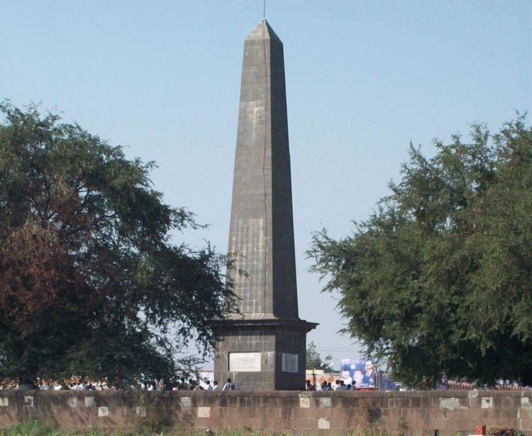
The Battle of Koregaon took place on January 1, 1818 between the army of Baji Rao II of the Maratha Empire, and a small East India Company force consisting mostly of Mahars with British officiers. The Koregaon pillar, an obelisk, stands at the battle site, and commemorates the brave and victorious Mahar soldiers.
Demographics
In the 2001 census, the village of Koregaon Bhima had 8,999 inhabitants, with 5,178 males (57.5%) and 3,821 females (42.5%), for a gender ratio of 738 females per thousand males.