
 | ||
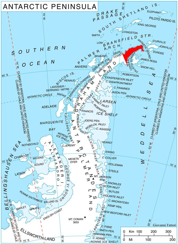
Kondofrey Heights (Bulgarian: Кондофрейски възвишения, ‘Kondofreyski Vazvisheniya’ kon-do-'frey-ski v&z-vi-'she-ni-ya) are the heights rising to 1119 m (Skakavitsa Peak) on the southeast side of Trinity Peninsula, Antarctic Peninsula. Situated east of Detroit Plateau, south of Victory Glacier and west of Prince Gustav Channel, Weddell Sea. Linked to Detroit Plateau by Podgumer Col. Extending 9.2 km in east-west direction and 7.5 km in north-south direction.
Contents
Map of Kondofrey Heights, Antarctica
The heights are named after the settlement of Kondofrey in western Bulgaria.
Location
Kondofrey Heights are located at 63°50′00″S 58°34′00″W. German-British mapping in 1996.
Maps
References
Kondofrey Heights Wikipedia(Text) CC BY-SA