
Official name Koma Kulshan Project Purpose Hydroelectricity Opening date October 1990 Impound Koma Kulshan Project | Country United States Status Operational Construction began 1989 | |
 | ||
Owners Covanta Energy, Atlantic Power Corporation Similar Upper Baker Dam, Snoqualmie Falls Hydroele, Puget Power Building, Lower Baker Dam, Wild Horse Wind Farm | ||
The Koma Kulshan Project is a 13.3 MW run-of-the-river hydroelectric generation facility on the slopes of Mount Baker, a stratovolcano in Washington state's North Cascades. The project commenced commercial operation in October 1990, and is owned by a Covanta Energy–Atlantic Power joint venture. It supplies Puget Sound Energy via a Power Supply Agreement (PSA) contract. Its single turbine is a Pelton wheel supplied by Sulzer Escher Wyss.
Contents
Located in the Mount Baker National Forest, it is one of six Federal Energy Regulatory Commission (FERC)-licensed small hydro installations on Federal Government land in Washington state.
Koma Kulshan is the name of Mount Baker in the Lummi dialect.
Dams
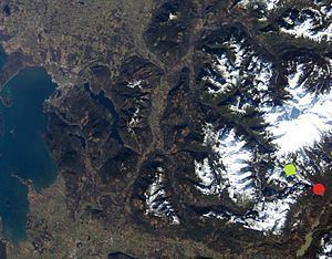
Intakes are located at diversion dams on the Rocky Creek and Sulphur Creek tributaries of Lake Shannon. A 42–45-inch (1,100–1,100 mm) diameter, 19,250-foot (5,870 m) long penstock carries water from a bifurcation (48.6914°N 121.7919°W / 48.6914; -121.7919 (Penstock head), 2,750 feet (840 m) a.s.l.) to the powerhouse. Water is discharged from the powerhouse through a short run on Sandy Creek to Baker Lake. Up to 120 cubic feet per second (3.4 m3/s) is diverted to the powerhouse.
Rocky Creek Dam (48.6849°N 121.8065°W / 48.6849; -121.8065 (Rocky Creek diversion dam)) is 18 feet (5.5 m) high, 32 feet (9.8 m) long at 2,770 feet (840 m) a.s.l.
Sulphur Creek Dam (48.6928°N 121.7928°W / 48.6928; -121.7928 (Sulphur Creek diversion dam)) is 15 feet (4.6 m) high, 37 feet (11 m) long at 2,755 feet (840 m) a.s.l.
Diversion of the creek affected the appearance of Upper and Middle Sulphur Creek Falls.
Peak generation
Power generation peaks in May through July coinciding with snowmelt, and has a smaller peak in November coinciding with the wet season.