
Local time Thursday 10:54 PM | ||
 | ||
Weather 4°C, Wind SW at 23 km/h, 80% Humidity | ||
Kolbu is a village in Østre Toten municipality, Oppland county, Norway. It is located in the traditional region of Toten. Kolbu is situated about six kilometers southwest of the municipal center of Lena.
Contents
Map of 2847 Kolbu, Norway
Kolbu was a municipality for 56 years. The municipality of Kolbu was created by a split from Vestre Toten on 1 January 1908. At that time Kolbu had a population of 2,412. On 1 January 1964, the majority of Kolbu with 2,906 inhabitants was incorporated into Østre Toten.
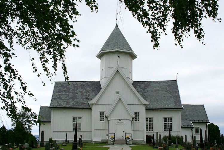
Kolbu Church is a cruciform church from 1730. It was built of timber and has 460 seats.
The name
The Norse form of the name was Kolabú. The first element is the genitive plural case of kol n 'coal', the last element is bú n 'rural district'. The first element is referring to the practice of making coal by burning wood.
Schools
In 2008, the Smeby, Lund and Moen primary schools merged under the name Kolbu School (Kolbu Skole) . Students graduating from this school usually have to continue their education in Lena secondary school.