
Primary outflows Terminal Max. length 5 miles (8.0 km) Surface elevation 579 m Width 4.8 km | Max. width 3 miles (4.8 km) Length 8 km Shore length 30 km | |
 | ||
Location Mojave DesertKern County, California References U.S. Geological Survey Geographic Names Information System: Koehn Lake | ||
Koehn Lake is a dry lake, and seasonally endorheic lake, in the Fremont Valley of the Mojave Desert, in eastern Kern County, California.
Contents
Map of Koehn Lake, California 93519, USA
GeographyEdit
The valley is 19 km (12 mi) northeast of California City, and east of Red Rock Canyon State Park.
The lake is approximately 5 miles (8.0 km) long and 3 miles (4.8 km) at its widest point.
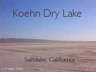
The nearby ghost town of Saltdale was founded in 1915, for salt harvesting from the dry lakebed. The ghost town of Garlock is on the north. The southern portal of Burro Schmidt Tunnel overlooks the dry lake and Fremont Valley.
References
Koehn Lake Wikipedia(Text) CC BY-SA