
Zone Semien Wollo Zone Elevation 1,468 m | Time zone EAT (UTC+3) Local time Thursday 5:35 PM | |
 | ||
Weather 27°C, Wind E at 10 km/h, 29% Humidity | ||
Kobo is a town in northern Wollo Ethiopia. Located in the Semien Wollo Zone of the Amhara Region, this town has a longitude and latitude of 12°09′N 39°38′E with an elevation of 1468 meters above sea level. It is the administrative center of Kobo woreda.
Contents
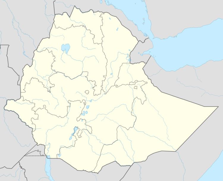
Map of Kobo, Ethiopia
Kobo is located on the Addis Ababa-Axum highway (Ethiopian Highway 2), 189 kilometers south of Mekele. A road from Kobo west to Lalibela has existed since the 1930s, but as of 1999, it is usable only in good weather by four-wheel vehicles.
History
Kobo is part of a mid-altitude area which lies between the Ethiopian Highlands to the west and the Afar Depression to the east. The northern portion of this area is known as Raya. Raya is a flat plain which extends north from Kobo woreda into the Raya Azebo woreda in Tigray. Similar areas exist on the eastern edges of Yejju, Wollo, and Shewa further south. This area has been involved in disputes between the Christian highlanders and Muslims from the east since the time of the Ifat Sultanate (13th century). Much of the early conflict took place further south on the eastern border of what is now Shewa. However, in the 16th century, the Raya area was the site of an important conflict in Ethiopian history between the armies of the General of Adal, Ahmad ibn Ibrahim al-Ghazi, known better amongst Ethiopians as Imam Ahmed Gragn, and the Abyssinian forces of Lebna Dengel. This infamous period of conflict was known as the Ethiopian-Adal War. The Ethiopians asked for help from the Portuguese, who arrived at port of Massawa on February 10, 1541. In April 1542 the two armies met north of Lake Ashenge (near Korem in Tigray). This marked the first use of firearms by the Abyssinian military.
The battle was inconclusive. Ahmed and his forces spent the rainy season at Zobil Mountain (east of Kobo) while the Ethiopian forces stayed at near Lake Ashenge. Ahmed sent for armed assistance from the Ottoman Empire in Arabia. According to Abbé João Bermudes, Imam Ahmad received 2000 musketeers from Arabia, and artillery and 900 picked men from the Ottomans. When Ahmed attacked the position near Lake Ashenge after the rainy season, he was successful and the Christian Army moved back further west. Eventually the Christians were victorious and Adal collapsed.
Most of the army of Ahmed was Somali or Afar, but some local Muslims from the Eastern fringe of the highlands participated. The mid-altitude eastern fringe acquired a reputation of rebelliousness with respect to highland rule.
The war between Adal and the Christian Highlanders weakened both. Southern Oromo people (previously called Galla by the Somalis and Christian highlanders) moved into the mid-altitude fringe areas and established their culture and language as far north as Raya Azebo. It is uncertain to what extent the Oromo moved whole communities, to what extent victorious Oromo raiders settled down with local women, and to what extent the Oromo were already present. Oromo culture and language became more important in the area after the 15th century, although the Oromo in the area tended to become either Muslim or Christian and gave up their pagan traditions. The Oromo were successful due to their community tribal organization. The internal community organization of the Oromo communities gave them an independent character. The independence of the Oromo communities in the mid-altitude fringe areas also contributed to the reputation of the area for rebelliousness. The herding people of the Raya area tended have been influenced by both Muslim and Oromo rebellious traditions.
From 1928 until 1930 there was a large revolt over taxes and central government control in the Raya area. The military and areal bombardment was used to regain central control. This marked the first use of air power in Ethiopia. Some of the local rebels were involved with attacking Ethiopian forces when the Italians invaded in 1936. In January 1942 a clash at Kobo between locals and soldiers collecting taxes led to three British officers and nine Ethiopian soldiers killed. The Ethiopian government responded with an aerial bombardment of the town. This skirmish was one of the events which lead up to the Woyane rebellion. There was another Raya revolt in 1947–48. Repression of this revolt also involved areal bombardment.
Dejazmach Gobana Dacche had been given a land grant of 500 hectares near Waja (12° 17’ N 39° 36’ E) for his service in fighting the Italians between 1936 and 1941. He received this land after World War II. Nobility of this sort served to pacify the area for the central Ethiopian government. However he took additional land from his farmer neighbors. He was taken to court by the neighbors. They won the case but the administration refused to enforce the ruling. At harvest time in 1971 when Gobena went to the fields to take the grain from the area that he claimed, he was attacked and killed by a large group of local men. The response of the Ministry of Interior was to send the Army to Kobo to make it clear that the central government was in control. This can be seen as part of the tradition of the Government of Ethiopia to extend central control which took place throughout the 19th and 20th centuries under both the traditional governments and their successors.
In mid-1972, a young District Development Officer, Abebaw Kasai, sent a full report concerning conditions in the district to the Ministry of Community Development; this was the first warning of what became the brutal 1973–74 famine which set off the Ethiopian Revolution and led to the fall of Emperor Haile Selassie. The report was received with interest by the Ministry of Community Development, but was rejected by the Ministry of the Interior. Abebaw was severely reprimanded and told never to send such a negative report again. The Ministry of Agriculture commissioned a survey of the crop situation at harvest time in 1972. The survey was conducted by Paul Christensen, a United States Peace Corp volunteer. The survey accurately predicted that if the 1973 crops failed, about 220,000 people would be without food. The crops did fail in 1973.
The failure of the Ministry of the Interior to respond to the famine may be seen as a form of punishment for the local tendency to rebel, as well as a fatalism on the part of the central government when faced with acts of God.
Oxfam also declined to get involved in preparations for the famine prior to the appearance of beggars in the streets during the rainy season of 1973. After the effects of the famine became visible, Oxfam ran a famous television piece on the famine in Britain. The Catholic Relief Services provided effective relief in 1973–74. The Ministry of Rural Development and the Ministry of Agriculture provide food-for-work assistance through program which built the road from the plains to Zobil Mountain. The program distributed grain from the United States Agency for International Development.
During the abbreviated rainy season of 1973, with the displacement caused by the famine, cholera broke out in lowland Wollo. The Catholic Relief Service had organized health care in Kobo for those displaced by the famine and weakened by malnutrition. The rehydration provided at the Kobo station saved many lives among the cholera victims.
In May 1983 the Catholic Relief Services made grant distributions from the Agency for International Development at Kobo in response to the later famine, By the next year, with the famine clearly underway, several thousand Afar people had come to the Catholic mission in Kobo in search of help; they had fled the lowlands after losing all their livestock. Between 15 October and 2 November 1989 Kobo was subjected to four air attacks by the government forces. Casualties are not known, but the clinic was strafed by helicopter gunships.
In March 2007, the Amhara Regional Rehabilitation and Development Agency announced the creation of a state-owned cotton processing factory, and a cotton plantation on 305 hectares to supply it, with a capitalization of 63 million Birr. The next month the Ethiopian Catholic Church announced the completion of a modern hospital with 50 beds.
Demographics
Based on figures from the Central Statistical Agency in 2005, this town has an estimated total population of 36,147 of whom 18,552 are men and 17,595 women. The 1994 census reported this town had a total population of 20,788 of whom 9,761 were men and 11,027 women.