
Highest elevation 10 m (30 ft) | ||
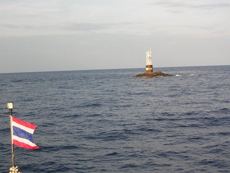 | ||
Ko Losin (Thai: เกาะโลซิน, [kɔ̀ʔ loːsin]) is a small rocky islet in the southern area of the Gulf of Siam. It is under the Panare District (administrative area) of the Pattani Province of Thailand.
Contents
Map of Ko Losin
Owing to the islet's relative remoteness, the area around Ko Losin is a good diving spot, where sharks and mantas thrive undisturbed.
Territorial dispute
Though barren and uninhabited, Ko Losin, along with the islet of Ko Kra (8°23′49″N 100°44′13″E), constitutes a disputed territory. The dispute over the continental shelf boundary between Malaysia and Thailand arises from the different baselines which the two countries adopt in calculating the equidistant line for boundary. Thailand's proclaimed baseline runs from the terminus at Kuala Tabar (the eastern terminus of the Malaysia-Thailand land border as defined by the Anglo-Siamese Treaty of 1909) northwards to Ko Losin islet and then northwestwards to Ko Kra. Malaysia however does not regard Ko Losin as a valid baseline point and calculates the equidistant line on a baseline running along the shore.