
Elevation 276 m Province Connacht | OSI/OSNI grid G556192 Prominence 171 m Listing Marilyn | |
 | ||
Similar Knockalongy, Trusk, Knock - Mayo, Letterbreckaun, Slieve Carr | ||
Knocknashee (Cnoc na Sì in Irish) is a 276 m Marilyn in the Ox Mountains, County Sligo, Ireland.
Contents
- Map of Knocknashee Knocknashee Common Co Sligo Ireland
- GeographyEdit
- GeologyEdit
- ArchaeologyEdit
- NameEdit
- References
Map of Knocknashee, Knocknashee Common, Co. Sligo, Ireland
GeographyEdit
The River Moy rises at the foot of Knocknashee.
GeologyEdit
Knocknashee hill consists of a limestone top with shales underlying the lower slopes.
ArchaeologyEdit
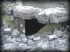
Knocknashee was identified as a hilltop fort in 1988. It is an enclosed hill fort with limestone ramparts containing cairns, burial chambers and hutsites. The fort is 700 metres long and 320 metres wide and is enclosed by two earth and stone ramparts covering an area of 53 acres. The site was discovered during an aerial survery of county Sligo by the Office of Public Works in 1988.
NameEdit
The name of the plateau itself comes from Irish, ‘knock’ (cnoc) meaning ‘hill’ and ‘shee’ (sí) meaning ‘burial mound’ or 'of the fairies'. In older Irish Knocknashee is known as Mullinabreena.