
Length 17 km (11 mi) Trail difficulty Easy | Elevation change 1,513 m (4,964 ft) | |
 | ||
Lowest point Niederbreitbach, 130 m (430 ft) | ||
Klosterweg quicksand
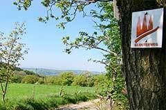
The Klosterweg is a hiking trail in Rhineland-Palatinate, Germany. The trail is 17 km long and connects Rengsdorf viaKurtscheid with Waldbreitbach leading through the Westerwald forest.
Contents
Studentenwohnheim klosterweg 7 karlsruhe kw7
Description
Leading through the Naturpark Rhein-Westerweld]] the trail connects two popular long distance trails in Rhineland-Palatinate, the Rheinsteig in Rengsdorf and the Westerwaldsteig in Waldbreitbach. The trail was opened in May 2009. In October 2009 the Klosterweg received the Premiumweg quality label.
The Klosterweg leads along following sights:
References
Klosterweg Wikipedia(Text) CC BY-SA