
Time zone CET/CEST (UTC+1/+2) Area 5.1 km² Local time Sunday 7:16 AM Postal code 56581 | Elevation 383 m (1,257 ft) Postal codes 56581 Dialling code 02634 Population 992 (31 Dec 2008) Municipal assoc. Rengsdorf | |
 | ||
Weather 9°C, Wind W at 8 km/h, 97% Humidity | ||
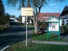
Kurtscheid is a municipality in the district of Neuwied, in northern Rhineland-Palatinate, Germany. The village is located in the natural preserve Rhein-Westerwald. Kurtscheid is 401 metres above sea level and is hence the highest municipality in the district of Neuwied.
Contents
Map of Kurtscheid, Germany
History
In 1314, the village was officially mentioned for the first time as "Curtsheit".
During the time of the Protestant reformation, Kurtscheid was situated on the border of the County of Wied and the Archbishopric of Cologne. In 1546, the Count of Wied decided to select Lutheranism as the general religion within his county. Thus, following the agreement of the Peace Treaty of Augsburg, all inhabitants of his county had to convert their religion accordingly. However, the citizens of Kurtscheid did not want to convert. Therefore, they demolished 11 houses which were situated on the duke's territory and rebuilt them on the archbishop's catholic part of the village. Kurtscheid stayed catholic and for the following centuries, a confessional border divided it from its Protestant neighbours.
Politics
The parish council consists of 12 members and the honorary mayor.
Seating in the elected council:
(Status: local elections on June 7, 2009)
Coat of arms
The crossed bars taken from the coat of arms of the County of Wied and the black cross coming from the Archbishopric of Cologne's coat are reminders of the century-long separation of Kurtscheid into parts belonging to the County of Wied and to Cologne, respectively. The mountain with three hills represents Kurtscheid's geographic position as highest municipality in the district of Neuwied. The golden colour symbolises agriculture life while the green colour indicates the grand amount of forests covering the municipality's territory. The silvern gear wheel represents both the former silver and iron ore mines and today's industry.