
Area rank 337 in Norway Area 186.4 km² Local time Thursday 8:05 AM | Administrative centre Klæbu Demonym(s) Klæbygg Population 5,801 (2010) | |
 | ||
Weather 0°C, Wind SE at 10 km/h, 86% Humidity | ||
Klæbu is a village and municipality in Sør-Trøndelag county, Norway. It is located in the southern part of the Trondheim Region, about 20 kilometres (12 mi) south of the city of Trondheim. The administrative center is the village of Klæbu. The other major village in Klæbu is Tanem.
Contents
Map of Kl%C3%A6bu, Norway
The village of Klæbu is located along the Nidelva river. The 1.57-square-kilometre (390-acre) village has a population (2013) of 3,187. The population density is 2,030 inhabitants per square kilometre (5,300/sq mi).
Even though agriculture has traditionally been the main industry for Klæbu, the municipality now functions more as a commuter town of Trondheim, where many of Klæbu's inhabitants work or attend school.
It is scheduled to merge with the municipality Trondheim January 1st 2020.
General information
The municipality of Klæbu was established on 1 January 1838 (see formannskapsdistrikt). On 1 January 1899, the small northwestern part of Klæbu (population: 533) was separated from Klæbu to form the new municipality of Tiller.
Name
The Norse form of the name was Kleppabú. The first element is the plural genitive case of kleppr 'rocky hill' - the last element is bú 'rural district'. The district/parish has a lot of small rocky hills.
Coat-of-arms
The coat-of-arms is from modern times; they were granted on 8 July 1983. The silver and blue arms symbolize the Trangfossen waterfall in the Nidelva river, which is now the deepest canyon in Norway measuring 56 meters (183 feet). The river has been of great importance for the local development, for agriculture and hydroelectricity generation, hence the use of the waterfall as a typical symbol for the municipality. The waterfall is no longer visible as that part of the river became part of Bjørsjøen lake after the building of the dam at Hyttfossen.
Churches
The Church of Norway has one parish (sokn) within the municipality of Klæbu. It is part of the Deanery (prosti) of Heimdal and the Diocese of Nidaros.
Geography
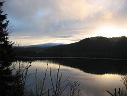
The Nidelva river, which runs through Klæbu, is a large source of hydroelectric power with a total of 3 power stations within the municipality borders. The river runs north from the lake Selbusjøen. The mountain Vassfjellet is located along the western border with Melhus.
The landlocked municipality of Klæbu has three municipalities that border it: Melhus is located to the west and south, Selbu is located to the east, and Trondheim is to the north.