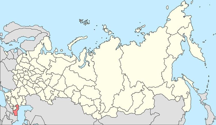
Administratively subordinated to Town of Kizilyurt Area 50 km² | Federal subject Republic of Dagestan Urban okrug Kizilyurt Urban Okrug Local time Thursday 3:58 AM | |
 | ||
Administrative center of Kizilyurtovsky District, Town of Kizilyurt Administrative center of Kizilyurt Urban Okrug, Kizilyurtovsky Municipal District Weather 4°C, Wind NW at 6 km/h, 93% Humidity | ||
Kizilyurt (Russian: Кизилю́рт; Avar: Чирюрт; Kumyk: Къызылюрт) is a town in the Republic of Dagestan, Russia, about 53 kilometers (33 mi) northwest of Makhachkala. Population: 32,988 (2010 Census); 30,264 (2002 Census); 33,682 (1989 Census).. It is located where the north-flowing Sulak River leaves the mountains and enters the Terek-Sulak Lowland.
Contents
- Map of Kizilyurt Dagestan Republic Russia
- History
- Administrative and municipal status
- Demographics
- References
Map of Kizilyurt, Dagestan Republic, Russia
History
It was founded in 1963 by merging the work settlements of Kizilyurt, Bavtugay (Бавтугай), and Sulak (Сулак).
Administrative and municipal status
Within the framework of administrative divisions, Kizilyurt serves as the administrative center of Kizilyurtovsky District, even though it is not a part of it. As an administrative division, it is, together with two settlements of urban type (Bavtugay and Novy Sulak) and one rural locality (the selo of Stary Bavtugay), incorporated separately as the Town of Kizilyurt—an administrative unit with the status equal to that of the districts. As a municipal division, the Town of Kizilyurt is incorporated as Kizilyurt Urban Okrug.
Demographics
Ethnic groups in the city administrative area (2002 census):
Ethnic groups in the city itself (2002 census):
