
Area 118.5 km² Local time Thursday 6:45 AM | Population 60,977 (Jun 2008) University Dohto University | |
 | ||
Time zone Japan Standard Time (UTC+9) City hall address 4-2-1, Chūō, Kitahiroshima-shi, Hokkaidō061-1192 Website www.city.kitahiroshima.hokkaido.jp Weather 0°C, Wind NW at 32 km/h, 65% Humidity | ||
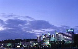
Kitahiroshima (北広島市, Kitahiroshima-shi) is a city located in Ishikari, Hokkaido, Japan. "Kita" is the Japanese word for "north", so the town's name, Kitahiroshima-shi, is translated as "North-Hiroshima city" or "city of North-Hiroshima".
Contents
- Map of Kitahiroshima Hokkaido Prefecture Japan
- History
- private
- Public
- Private
- Rail
- Road
- Twinnings
- References
Map of Kitahiroshima, Hokkaido Prefecture, Japan
In 2004, the population reached over 60,000 and as of 2008, the city has an estimated population of 60,977 and the density of 514 persons per km². The total area is 118.54 square kilometres (45.77 sq mi).
History
On September 1, 1996, Hiroshima town was reorganized to promote city status, but Hiroshima city already existed, on the west of Honshu island. Therefore, Hiroshima was renamed to Kitahiroshima on that day.
private
Public
Private
Rail
Road
It is accessed by routes 36, 274 and the expressway interchange in the west. In 1981, the bypass of route 274 was opened and the bypass of route 36 was opened in 1986. The urban sprawl of the Sapporo area in the western part of the city is bypassed.