
Website www.city.kita.tokyo.jp Population 340,287 (1 May 2015) | Region Kantō Area 20.61 km² Prefecture Tokyo | |
 | ||
Time zone Japan Standard Time (UTC+9) Colleges and Universities Tokyo Seitoku College, Seibi Gakuen College, Tokyo Seitoku University Points of interest Kyu‑Furukawa Gardens, Asukayama Park, Akabaneshizenkansatsu Park, Ōjiinari Shrine, Kitaku Central Park | ||
Kita (北区, Kita-ku, "Northern Ward") is a special ward located in Tokyo Metropolis, Japan. The English translation of its Japanese self-designation is City of Kita. The ward was founded on March 15, 1947.
Contents
- Map of Kita Tokyo Japan
- History
- Geography
- Famous sites
- Economy
- Education
- Rail
- Highways
- Notable people from Kita
- International relations
- References
Map of Kita, Tokyo, Japan
As of May 1, 2015, the ward has an estimated population of 340,287 and a population density of 16,510 persons per km². The total area is 20.61 km².
History
The area was a collection of rural villages and towns until the 1880s, when it was connected by rail to central Tokyo (Oji Station opening in 1883). Parts of the area joined Tokyo City in 1932 as the Oji and Takinogawa wards. Kita was officially formed in 1947 by the merger of these wards.
Geography
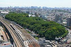
The name Kita, meaning "north," reflects the location among the wards of Tokyo. To its north lie the cities of Kawaguchi and Toda in Saitama Prefecture. To the east, south and west lie other special wards: Adachi, Arakawa, Itabashi, Bunkyō, and Toshima.
Rivers include the Arakawa River and the Sumida River.
Famous sites
Economy
The head office of Seiyu Group is in Kita.
Education
The city's public elementary and middle schools are operated by the City of Kita Board of Education.
The city's public high schools are operated by the Tokyo Metropolitan Government Board of Education.
The following international schools are in the ward:
The following universities are in the ward:
Rail
Highways
Notable people from Kita
International relations
Kita has a sister city relationship with Xuanwu District, Beijing, China.
It is also twinned with the following cities in Japan.