
- Flower Somei Yoshino cherry Population 13,092 (Feb 2015) Local time Friday 9:10 AM | Region Kantō - Tree Japanese Red Pine Area 58.61 km² | |
 | ||
Weather 9°C, Wind NW at 14 km/h, 61% Humidity | ||
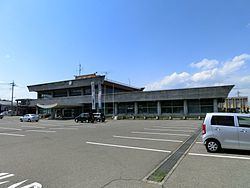
Kanra (甘楽町, Kanra-machi) is a town located in Kanra District of southwestern Gunma Prefecture in the northern Kantō region of Japan. As of February 2015, the town had an estimated population of 13,092 and a population density of 223 persons per km². Its total area was 58.61 km².
Contents
- Map of Kanra Kanra District Gunma Prefecture Japan
- Geography
- Surrounding municipalities
- History
- Economy
- Education
- Railway
- Highway
- Local attractions
- References
Map of Kanra, Kanra District, Gunma Prefecture, Japan
Geography
Kanra is located in the southwestern portion of Gunma Prefecture.
Surrounding municipalities
History
During the Edo period, the area of present-day Kanra was largely part of Obata Domain, a feudal domain under the Tokugawa shogunate in Kōzuke Province. Obata village, Akihata village, Fukushima town, and Niiya village were created within Kitakanra District of Gunma Prefecture on April 1, 1889 with the creation of the municipalities system after the Meiji Restoration. In 1925 Obata village was elevated in status into Obata town. In 1950 Kitakanra District was renamed Kanra District. Akihata village merged with Obata in 1955, and Fukushima and Niiya villages were into Obata on February 1, 1959, creating Kanra town.
Economy
The economy of Kanra is heavily dependent on agriculture.