
Admin. region Gießen Elevation 215-388 m (−1,058 ft) Area 79.88 km² Local time Wednesday 7:09 PM Dialling code 06635 | Time zone CET/CEST (UTC+1/+2) Population 3,316 (30 Jun 2009) Postal code 36320 Administrative region Giessen | |
 | ||
Weather 11°C, Wind W at 5 km/h, 67% Humidity | ||
Kirtorf is a town in the northern Vogelsbergkreis in Hesse, Germany. Through the town runs the Deutsche Märchenstraße, or German Fairytale Road, a touristic route joining many of the places commonly associated with the Brothers Grimm's tales.
Contents
- Map of Kirtorf Germany
- Geography
- Neighbouring communities
- Constituent communities
- History
- Amalgamations
- Politics
- Coat of arms
- Town partnerships
- Museums
- Buildings
- Transport
- References
Map of Kirtorf, Germany
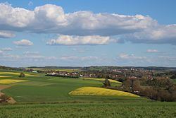
Geography
The town lies at the top of the Rhine-Weser watershed between the east-flowing Antrift and the west-flowing Gleen.
Neighbouring communities
Kirtorf borders in the north on the town of Neustadt (Marburg-Biedenkopf), in the east on the community of Antrifttal, the town of Alsfeld and the community of Romrod, in the south on the community of Gemünden, and in the west on the town of Homberg (Ohm), and the town of Stadtallendorf (Marburg-Biedenkopf).
Constituent communities
Besides the town's main centre, which bears the same name as the whole municipality, there are outlying centres named Arnshain, Gleimenhain, Heimertshausen, Lehrbach, Ober-Gleen and Wahlen.
History
Kirtorf was mentioned in a document as Gleene in 917. Kirtorf was the seat of a Sendgericht, a church court that tried cases of sin, vice and the like, under the Bishopric of Mainz. This court included 40 places. From 1205, the town belonged to the Abbey of Fulda, the Counts of Ziegenhain were the Vögte ( ≈ sheriffs) here and held jurisdiction in the Eußergericht court district until the 14th century. By 1366, the Landgraves of Hesse had come into ownership of some parts of the court district. Kirtorf's town rights were granted in 1489. On 1 April 1725, the town almost completely burnt down; only the town hall (built in 1559) was left standing and unscathed.
Amalgamations
All constituent communities named above were united as part of Hesse's municipal reforms in 1971.
Politics
Kirtorf's town council has 23 councillors. As of municipal elections held on 26 March 2006 the seats are apportioned thus:
Note: FWG and UWL are citizens' coalitions.
Coat of arms
Kirtorf's civic coat of arms shows the helmet and crest of the Counts of Hesse. The oldest example of the arms is in a seal dating from 1489. Some former versions of the town's arms have red as the background colour instead of blue.[1]
Town partnerships
Museums
Buildings
Transport
Through the town runs Federal Highway (Bundesstraße) B 62.