
Area rank Ranked 15th Postal code 25000-27999 Area 24,588 km² Population 995,171 (2013) | Time zone EET (UTC+2) Area code +380-52 Founded 10 January 1939 ISO 3166 code ISO 3166-2:UA | |
 | ||
Clubs and Teams FC Oleksandriya, FC Zirka Kropyvnytskyi, FC Olimpik Kropyvnytskyi, FC Zirka-2 Kropyvnytskyi Points of interest City Dendropark, Southern Bug, Kovalivs'kyi park, Kirovogradskiy oblastnoy kraevedc, Kirovograd Regional Art Muse Destinations Kropyvnytskyi, Oleksandriia, Svitlovodsk, Znamianka, Kremenchuk Reservoir | ||
Kirovohrad Oblast (Ukrainian: Кіровоградська область, translit. Kirovohrads’ka oblast’; also referred to as Kirovohradschyna - Ukrainian: Кіровоградщина) is an oblast (province) of Ukraine. The administrative center of the oblast is the city of Kropyvnytskyi, formerly known as Kirovograd. Population: 995,171 (2013 est.).
Contents
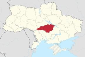
- Map of Kirovohradska Ukraine
- Geography
- History
- Points of interest
- Administrative divisions
- Age structure
- Median age
- Nomenclature
- References
Map of Kirovohradska, Ukraine
Geography
The area of the province is 24,600 km2 (9,498.11 sq mi).
The city of Dobrovelychkivka is the geographical center of Ukraine.
History
The oblast was created as part of the Ukrainian Soviet Socialist Republic on January 10, 1939 out of the northern raions of Mykolaiv Oblast. In 1954 the oblast lost some raions to the newly created Cherkasy Oblast, but later that year received its western raions from the Odessa Oblast.
Points of interest
The following sites were nominated for the Seven Wonders of Ukraine:
Administrative divisions
The Kirovohrad Oblast is administratively subdivided into 21 raions (districts) as well as 4 cities (municipalities) which are directly subordinate to the oblast government: Oleksandriia, Svitlovodsk, Znamianka, and the administrative center of the oblast, Kropyvnytskyi.
Note: Asterisks (*) Though the administrative center of the rayon is housed in the city/town that its named after, cities do not answer to the rayon authorities only towns do; instead they are directly subordinated to the oblast government and therefore are not counted as part of rayon statistics.Age structure
0-14 years: 14.3% (male 72,646/female 68,970)15-64 years: 68.7% (male 324,698/female 355,058)65 years and over: 17.0% (male 55,718/female 111,666) (2013 official)Median age
total: 41.2 years male: 37.7 years female: 44.5 years (2013 official)Nomenclature
Most of Ukraine's oblasts are named after their capital cities, officially referred to as "oblast centers" (Ukrainian: обласний центр, translit. oblasnyi tsentr). The name of each oblast is a relative adjective, formed by adding a feminine suffix to the name of respective center city: Kirovohrad is the center of the Kirovohrads’ka oblast’ (Kirovohrad Oblast). Most oblasts are also sometimes referred to in a feminine noun form, following the convention of traditional regional place names, ending with the suffix "-shchyna", as is the case with the Kirovohrad Oblast, Kirovohradshchyna.