
Admin. region Detmold Elevation 53 m (174 ft) Area 33.78 km² Population 16,100 (31 Dec 2010) Administrative region Detmold | Time zone CET/CEST (UTC+1/+2) Local time Tuesday 5:50 PM Postal code 32278 | |
 | ||
Weather 13°C, Wind SW at 14 km/h, 65% Humidity | ||
Ankunft kirchlengern 20 03 2016
Kirchlengern is a municipality in the district of Herford, in North Rhine-Westphalia, Germany.
Contents
- Ankunft kirchlengern 20 03 2016
- Map of Kirchlengern Germany
- Maish ckseln f r die bga e on kirchlengern mit case claas fendt john deree und jcb
- Geography
- Neighbouring places
- Division of the municipality
- Mayors
- Notable Persons
- References
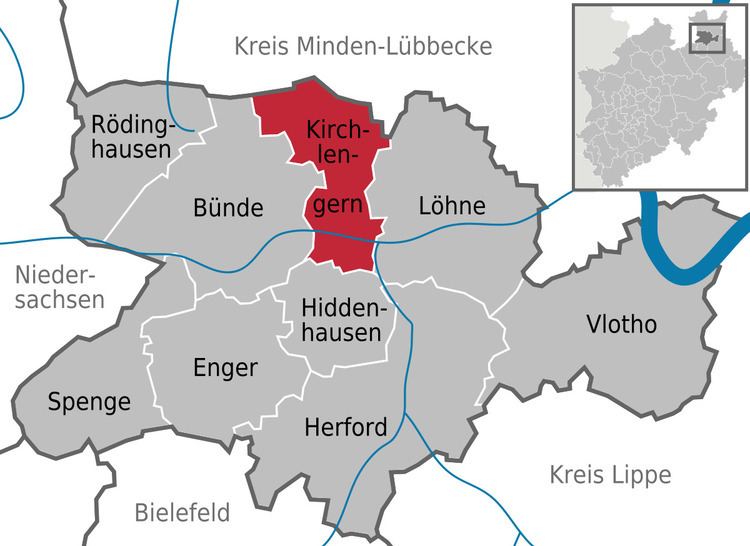
Map of Kirchlengern, Germany
Maish ckseln f r die bga e on kirchlengern mit case claas fendt john deree und jcb
Geography
Kirchlengern is situated on the river Else, approx. 10 km north of Herford.
Neighbouring places
Division of the municipality
The municipality is divided in 7 districts:
- Häver (1,900 inhabitants)
- Kirchlengern (6,051 inhabitants)
- Klosterbauerschaft (2,568 inhabitants)
- Quernheim (1,549 inhabitants)
- Rehmerloh (203 inhabitants)
- Stift Quernheim (1,668 inhabitants)
- Südlengern (3,154 inhabitants)
Mayors
Notable Persons
References
Kirchlengern Wikipedia(Text) CC BY-SA