
Peak Kingston Peak | Elevation 7,323 ft (2,232 m) Country United States of America | |
 | ||
Topo map USGS Horse Thief Springs Similar Nopah Range, Silurian Hills, Resting Spring Range, Avawatz Mountains, Stepladder Mountains | ||
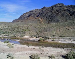
The Kingston Range, sometimes called the Kingston Mountains, is located in Inyo and San Bernardino counties in the Mojave Desert in eastern California. The range reaches a height of 7,323 feet (2,232 m) above sea level at Kingston Peak.
Map of Kingston Range, California, USA
The range is located southeast of the Nopah Range, and north of the Shadow Mountains and Interstate 15. The small community of Halloran Springs is about 22 miles (35 km) south of the Kingston Range. The range stretches about 18 mi (29 km) in a northeast-southwest direction. Tecopa Pass, at 5,100 ft (1,600 m), is located at the northeastern end of the mountains.
References
Kingston Range Wikipedia(Text) CC BY-SA