
Country Canada Anglican mission 1909 Elevation 53 m Population 389 (2016) Area code 867 | Time zone EST (UTC-5) Area 227 ha Local time Monday 9:39 PM Number of airports 1 | |
 | ||
Weather -23°C, Wind NW at 13 km/h, 72% Humidity | ||
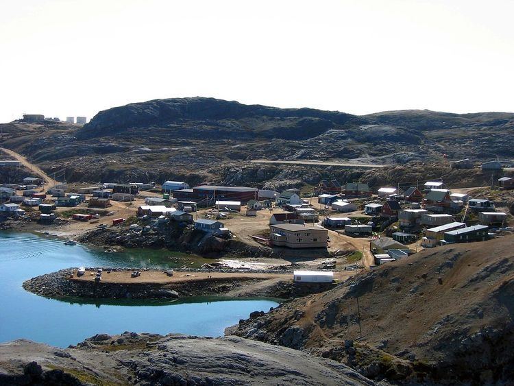
Kimmirut (Syllabics: ᑭᒻᒥᕈᑦ [kimːiɢut]; known as Lake Harbour until 1 January 1996) is a community in the Qikiqtaaluk Region, Nunavut, Canada. It is located on the shore of Hudson Strait on Baffin Island's Meta Incognita Peninsula. Kimmirut means "heel", and refers to a rocky outcrop in the inlet.
Contents
Map of Kimmirut, NU, Canada
It was at one time a Hudson's Bay Company trading post, and a Royal Canadian Mounted Police post. The Canadian explorer J. Dewey Soper used these posts as headquarters during his explorations in the 1920s and 1930s.
The community is served by Kimmirut Airport and by annual supply sealift. A proposal in 2005 for a road to Iqaluit was shown to be impractical owing to roundabout routing over the mountains.
As of the 2016 census the population was 389, a decrease of 14.5% from the 2011 census
Climate
Kimmirut has an Arctic climate (Köppen: ET), although it is well outside the Arctic Circle. The city has cold winters and short summers that are too cool to permit the growth of trees. It is north of the tree line, and average monthly temperatures are below freezing for eight months of the year. Kimmirut averages just over 335 mm (13.2 in) of precipitation annually, wetter than many other localities in the Canadian Arctic Archipelago, with the summer being the wettest season.