
OS grid reference TQ245835 Postcode district NW6, W9 | Sovereign state United Kingdom Dialling code 020 | |
 | ||
UK parliament constituencys Hampstead and Kilburn, Westminster North | ||
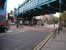
A rainy day on cricklewood broadway kilburn london
Kilburn is an area of north-west London, England, which is between London Borough of Brent postcodes: most of Kilburn is in the Brent but a small section is inside Westminster. West Kilburn which is Kilburn lane to the north, Fernhead road to the east, Harrow road to the south and Bravington road to the west comes under W9 City of Westminster. Kilburn is situated 3.75 miles (6.0 km) north-west of Charing Cross. The main thoroughfare running northwest-southeast is Kilburn High Road, part of the modern A5 road which forms the boundary between the boroughs of Brent and Camden. The road dates back to pre-Roman times and is part of the Roman road known as Watling Street. The town of Kilburn has its origins in a 12th-century priory on the banks of the Kilburn Brook. Kilburn today is a busy and multicultural London district. It has one of the capital's highest Irish populations, as well as a sizable Afro-Caribbean population. The area is identified in the London Plan as one of 35 major centres in Greater London.
Contents
- A rainy day on cricklewood broadway kilburn london
- Map of Kilburn London UK
- History
- Governance
- Demographics
- Kilburn High Road
- Gaumont State Cinema
- The Tricycle Theatre
- Other buildings
- Tubetrain
- Bus
- Sport
- Notable residents
- References
Map of Kilburn, London, UK
History
Kilburn High Road originated as an ancient trackway, part of a Celtic route between the settlements now known as Canterbury and St Albans. Under Roman rule, the route was paved. In Anglo-Saxon times the road became known as Watling Street.
Kilburn grew up on the banks of a stream which has been known variously as Cuneburna, Kelebourne and Cyebourne, which flows from Hampstead down through Hyde Park and into the River Thames. It is suggested the name means either Royal River or Cattle River ('Bourne' being an Anglo-Saxon word for 'river'). The river is known today as the River Westbourne. From the 1850s it was piped underground and is now one of London's many underground rivers.
The name Kilburn was first recorded in 1134 as Cuneburna, referring to the priory which had been built on the site of the cell of a hermit known as Godwyn. Godwyn had built his hermitage by the Kilburn river during the reign of Henry I, and both his hermitage and the priory took their name from the river.
Kilburn Priory was a small community of nuns, probably Augustinian canonesses. It was founded in 1134 at the Kilburn river crossing on Watling Street (the modern-day junction of Kilburn High Road and Belsize Road). Kilburn Priory's position on Watling Street meant that it became a popular resting point for pilgrims heading for the shrines at St Albans and Willesden. The Priory was dissolved in 1536-37 by Henry VIII, and nothing remains of it today. The priory lands included a mansion and a hostium (a guesthouse), which may have been the origin of the Red Lion pub, thought to have been founded in 1444. Opposite, the Bell Inn was opened around 1600, on the site of the old mansion.
The fashion for taking 'medicinal waters' in the 18th century came to Kilburn when a well of chalybeate waters (water impregnated with iron) was discovered near the Bell Inn in 1714. In an attempt to compete with the nearby Hampstead Well, gardens and a 'great room' were opened to promote the well, and its waters were promoted in journals of the day as cure for 'stomach ailments':
Kilburn Wells, near Paddington.—The waters are now in the utmost perfection; the gardens enlarged and greatly improved; the house and offices re-painted and beautified in the most elegant manner. The whole is now open for the reception of the public, the great room being particularly adapted to the use and amusement of the politest companies. Fit either for music, dancing, or entertainments. This happy spot is equally celebrated for its rural situation, extensive prospects, and the acknowledged efficacy of its waters; is most delightfully situated on the site of the once famous Abbey of Kilburn, on the Edgware Road, at an easy distance, being but a morning's walk, from the metropolis, two miles from Oxford Street; the footway from the Mary-bone across the fields still nearer. A plentiful larder is always provided, together with the best of wines and other liquors. Breakfasting and hot loaves. A printed account of the waters, as drawn up by an eminent physician, is given gratis at the Wells.
In the 19th century the wells declined, but the Kilburn Wells remained popular as a tea garden. The Bell was demolished and rebuilt in 1863, the building which stands there today. The Kilburn stretch of Watling Street, now called Edgware Road and Kilburn High Road, was gradually built up with inns and farm houses. Despite the discovery of a medicinal well in 1714, and the creation of gardens and a fine room to exploit the water, Kilburn did not attract any significant building until around 1819 in the area near St John's Wood.
Between 1839 and 1856 the newsagent and future First Lord of the Admiralty William Henry Smith lived in a house to the west of Kilburn High Road. Much of the area was developed in the last decades of the 19th century by Solomon Barnett, who named many of the streets after places in the West Country (e.g. Torbay) or after popular poets of the day (e.g. Tennyson) in honour of his wife.
The funeral of Michael Gaughan, an Irish republican bomber who was part of the Provisional Irish Republican Army (IRA) and died from hunger strike in 1974, took place on 8 June 1974, when over 3,000 mourners lined the streets of Kilburn and marched behind his coffin, which was flanked by an IRA 'honour guard', to a Requiem Mass held in the Church of the Sacred Heart of Jesus. The Biddy Mulligan's pub on High Road, which was popular among the local Irish population, was bombed in retaliation on 21 December 1975 by the Ulster Defence Association (UDA), an Ulster loyalist group during the Troubles of Northern Ireland. Although there were 90 people in the pub at the time of the bomb, there were few injuries, but it created fears that Ulster loyalist violence would spread to IRA strongholds in mainland Britain such as Kilburn, as most bombings in London at that time were from Irish republicans such as the IRA.
Governance
The boundary between the boroughs of Camden and Brent runs along the middle of Kilburn High Road. The electoral wards of 'Kilburn (Camden)' and 'Kilburn (Brent)' cover most of the area.
Demographics
Kilburn has a number of different ethnic groups, including people of Irish, Afro-Caribbean, Indian, Bangladeshi, Pakistani, Eritrean and Ethiopian descent. As the area is split between more than one London borough, statistics are gathered from different parts of Kilburn.
13% of the population was born in Ireland with an even higher percentage of second-generation (born in England of Irish descent) people, giving it the highest Irish population of any London area. Irish community activities, pubs, local GAA sports clubs, and annual St Patrick's Day celebrations are prominent in parts of the area. The 2007 Irish-language film Kings has been associated with Kilburn, and is based on Jimmy Murphy's play, The Kings of the Kilburn High Road.
The Kilburn ward of Brent was 28% White British, 17% White Other, and 12% Black African in the 2011 census. The Kilburn ward of Camden was 35% White British and 19% White Other. The Maida Vale ward of Westminster was 38% White British and 22% White Other.
Kilburn High Road
Kilburn High Road is the main road in Kilburn. It follows a part of the line of the Roman route, Iter III in the Antonine Itinerary, which later took the Anglo-Saxon name Watling Street. This was based on an earlier Celtic route from Verlamion to Durovernum Cantiacorum, modern day St Albans and Canterbury.
Running roughly north-west to south-east, it forms the boundary between the London boroughs of Camden to the east and Brent to the west. It is the section of the Edgware Road (itself part of the A5) between Shoot Up Hill and Maida Vale.
There are three railway stations on Kilburn High Road: Kilburn tube station (Jubilee line) at its northern end and a little to the south Brondesbury station (London Overground on the North London Line). Approximately 1.25 km (nearly a mile) further south is Kilburn High Road station (also London Overground, on the Watford DC Line). Kilburn Park tube station, on the Bakerloo line, lies a little west of the southern end of the High Road.
The green space of Kilburn Grange Park is located to the east side of Kilburn High Road.
The name of Ian Dury's first band, Kilburn and the High Roads, refers to this road, as does the Flogging Molly song, "Kilburn High Road" and the Shack song, "Kilburn High Road".
Gaumont State Cinema
A landmark in Kilburn High Road is the Grade II* listed Art Deco Gaumont State Cinema, designed by George Coles and opened in 1937. It was the biggest auditorium in Europe at the time, with seating for 4,004 people. For twenty years, the building was run as a bingo hall by Mecca Bingo. It is now owned by Ruach City Church.
The Tricycle Theatre
In 1980 the Tricycle Theatre was opened in a converted Foresters' Hall on Kilburn High Road north of Buckley Road. The Tricycle now includes a gallery, cinema as well as the theatre. It has a reputation for political dramas including dramatisations of significant court cases and a play about the US detention centre at Guantánamo Bay, Cuba, which subsequently transferred to the West End and to New York City. Reflecting the culturally diverse local community, the Tricycle theatre presents many international pieces and films, often in original language with English subtitles, and hosts or runs social and educational programmes.
Other buildings
To the south, the Kilburn skyline is dominated by the Gothic spire of St. Augustine's, Kilburn. Completed in 1880 by the architect John Loughborough Pearson, the church has an ornate Victorian interior, a carved stone reredos and screen and stained glass, adjacent to its partners, St Augustine's Primary and Secondary Schools. The church is sometimes nicknamed "the Cathedral of North London" due to its size - at the time of construction, it was the third-largest place of worship in London, after St Paul's Cathedral and Westminster Abbey.
Located at 10 Cambridge Avenue, just off Kilburn High Road, is "The Animals WW1 memorial dispensary". The building itself dates back to the early 1930s. Formally opened in March 1931, it treated over 6,000 animals in its first year. The front of the building has a large bronze plaque above the door as a memorial to animals killed in the first world war. It's an impressive piece of bronze sculpture by F Brook Hitch of Hertford. Next door at 12-14 Cambridge Avenue, is one of the only surviving London examples of a "Tin Tabernacle" from 1863, which is currently used by a local Arts charity. This very unusual building is grade 2 listed and is open to the public on Saturdays.
Just to the south of St. Augustine's on Carlton Vale stood the Carlton Tavern, a pub built in 1920-21 for Charrington Brewery and thought to be the work of the architect Frank J Potter. The building, noted for its unaltered 1920s interiors and faience tile exterior, was being considered by Historic England for Grade II listing when it was unexpectedly demolished in March 2015 by the property developer CLTX Ltd to make way for a new block of flats.
205 High Road was home to the Irish pub Biddy Mulligan's. It was built in 1862 as was originally known as the The Victoria Tavern. It was renamed in the 1970s, with the name Biddy Mulligan taken from a character of Irish comedian Jimmy O'Dea, a character dressed as a female street seller in Dublin from the 1930s onwards. The pub was bombed on 21 December 1975 by the Ulster Defence Association (UDA), an Ulster loyalist group that fought against Irish republicans in Northern Ireland (The Troubles). The pub was later renamed as Biddy's, before briefly turning into an Australian sports bar called Southern K, and then closing in 2009 to make way for a new Ladbrokes branch.
Tube/train
Kilburn High Road is served by several railway lines which traverse the road in an east-west direction, connecting the area with central London and outer north-west London suburbs. The railways were first introduced to Kilburn in 1852 when the LNWR opened Kilburn & Maida Vale station (today's Kilburn High Road railway station), followed by two stations opened in the Brondesbury area of Kilburn by the Hampstead Junction Railway (1860) and the Metropolitan Railway (1879). Numerous plans were drawn up at the turn of the 20th century to construct an underground railway tunnel under the length of the Edgware Road and Kilburn High Road, including an unusual scheme to build a type of subterranean monorail roller coaster, but these proposals were abandoned. Today, Kilburn is served by London Underground and London Overground from the following stations:
Despite its name, Kilburn tube station is situated in the north of the district while Kilburn Park station is in the town centre.
Bus
Kilburn is served by many bus routes that go along the High Road. Most routes come south from Cricklewood, and serve various points in central and west London.
Sport
Notable residents
Notable people who live or have lived in Kilburn include: