
Peak Yudychvumchorr Elevation 1,201 m | State/Province Kolsky Peninsula Area 1,300 km² | |
 | ||
Similar Lovozero Massif, Tersky Coast, Byrranga Mountains, "Snow Village" - excursion, Fersman Mineralogical Museum | ||
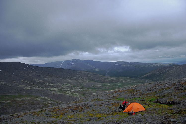
Trip to khibiny mountains
The Khibiny Massif, Khibiny Mountains, Khibinsky Mountains or Khibins, Khibinsky tundras, Khibiny (Russian: Хиби́ны [xʲɪˈbʲinɨ]) is one of the two main mountain ranges of the Kola Peninsula, Russia, within the Arctic Circle, located between Imandra and Umbozero lakes.
Contents
- Trip to khibiny mountains
- Map of Khibiny Mountains Murmansk Oblast Russia 184256
- Khibiny mountains
- Geography
- Climate
- Toponyms in Khibins
- References
Map of Khibiny Mountains, Murmansk Oblast, Russia, 184256
The massif is of oval shape of about 1,300 km2. and occupies the central part of the peninsula at a relative elevation of 900–1000 m above the surrounding plain. The mountains are not particularly high; the two highest peaks are the Yudychvumchorr, which stands 1,201 metres (3,940 ft), and the Chasnachorr, which stands 1,191 metres (3,907 ft). The average elevation is 1,116 metres (3,661 ft). The mountains form the shape of a horseshoe topped by a high plateau, drained by a series of deep canyons. The peaks are of plateau type, with steep slopes, with glaciers, icefields and snowfields in some places. The overall terrain is alpine tundra.
The second, and similar mountain range of the Kola Peninsula, the Lovozero Tundras, is located about 5 km east from the easternmost point of Khibiny.
The Khibiny range is extremely rich in minerals, mainly apatite and nepheline ores. 477 valid minerals have been reported and 108 of those are type localities or minerals first described in the Khibiny. The range is also seismically active.
Khibiny mountains are mostly uninhabited, except for one of the world's richest mineral quarries. One of the minerals discovered there is reported to have a potential as a nuclear waste radioactivity absorbent. By the foot of the massif the cities of Apatity and Kirovsk are situated.
Khibiny mountains
Geography
The Khibiny Mountains lie within the Kola Peninsula, a large peninsula extending from northern Russia into the Barents and White seas. The total land area of the peninsula is approximately 100,000 square kilometres (39,000 sq mi). It is rich in minerals due to the removal of a layer of soil during the last ice age.
Climate
Khibiny have an Arctic-moderate climate, with an average winter temperature of −5 °C (23 °F). However, the temperature can potentially drop to −30 °C (−22 °F) during the night. The Gulf Stream, which brings warmer water to the Kolsky Peninsula from the north, moderates the climate, making it slightly warmer than other Arctic regions.